Area Overview for B32 2EW
Photos of B32 2EW

Area Information
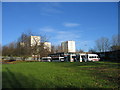
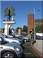
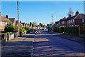
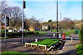
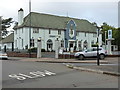
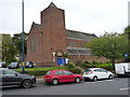
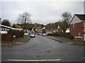
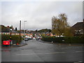
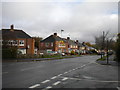
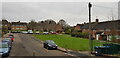
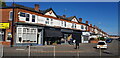
B32 2EW is a small residential postcode cluster in Birmingham’s Quinton area, home to 1,941 people. Nestled approximately 5 miles west of Birmingham city centre, it retains echoes of its historic village roots while accommodating modern housing. Originally part of Halesowen parish, Quinton became a Birmingham ward in 1909, blending Victorian terraced homes with later housing developments. The area’s character is defined by its suburban layout, with green spaces like Quinton Recreation Ground and Woodgate Valley Country Park offering respite from urban life. Daily life here balances proximity to Birmingham’s amenities with a quieter, community-focused rhythm. With rail and metro stations within reach, residents enjoy connectivity to the city’s core, while local shops and services—such as Co-op stores—provide convenience. The population, predominantly adults aged 30–64, reflects a mature demographic, with homes largely owned by residents rather than rented. This makes B32 2EW a stable, family-oriented neighbourhood with a distinct identity shaped by its history and infrastructure.
- Area Type
- Postcode
- Area Size
- Not available
- Population
- 1941
- Population Density
- 5626 people/km²
B32 2EW is a predominantly owner-occupied area, with 49% of properties owned by residents. The housing stock is largely composed of houses, reflecting a suburban layout that contrasts with denser urban developments. This mix of ownership and rental properties indicates a balance between long-term residents and those seeking temporary or flexible housing. The presence of houses rather than flats suggests a focus on family-friendly living, with larger properties accommodating multi-generational households or growing families. For buyers, this small postcode area offers a niche market, with limited availability due to its size. Proximity to Birmingham’s transport networks, including rail and metro stations, enhances its appeal for commuters. However, the 49% home ownership rate implies competition for properties, particularly in the existing Victorian terraced homes that retain historical character. Buyers should consider the area’s limited size, which may restrict options for expansion or development.
House Prices in B32 2EW
No properties found in this postcode.
Energy Efficiency in B32 2EW
Living in B32 2EW offers access to a range of amenities within practical reach. Local shops include Co-op stores in Harborne, Hagley, and Quinton, providing essentials and groceries. For transport, residents can use nearby rail stations like University Railway Station and Selly Oak Railway Station, as well as metro stops such as Edgbaston Village and Winson Green Outer Circle, ensuring easy access to Birmingham’s core and beyond. Recreational spaces include Quinton Recreation Ground and Woodgate Valley Country Park, offering opportunities for walking, cycling, and outdoor activities. The area’s historical character is complemented by green spaces and community hubs like Quinton Library and Quinborne Community Centre. This blend of convenience, natural beauty, and suburban tranquillity creates a lifestyle that balances urban accessibility with a slower pace of life. The presence of local amenities reduces the need for long commutes, making daily errands and leisure activities efficient and enjoyable.
Amenities
Schools
| Rank | School | Type | Entry gender | Ages |
|---|
Explore more schools in this area
Go to Schools tabDemographics
The population of B32 2EW is 1,941, with a median age of 47. The majority of residents are adults aged 30–64, indicating a mature, established community. Home ownership stands at 49%, suggesting a mix of owner-occupied and rental properties. The area is predominantly composed of houses, reflecting a residential profile that prioritises private living spaces over flats. The predominant ethnic group is White, though specific diversity metrics are not provided. This age demographic implies a focus on long-term stability, with many residents likely in their peak earning years or retired. The 49% home ownership rate suggests that while nearly half of properties are owned by residents, the remaining 51% may be rented, potentially attracting younger professionals or families seeking flexibility. The absence of detailed deprivation data means the area’s socioeconomic challenges remain unquantified, but the median age and housing stock suggest a relatively stable, middle-income environment.
Household Size
Accommodation Type
Tenure
Ethnic Group
Religion
Household Composition
Age
Household Deprivation
NS-SEC
Explore more demographic insights in this area
Go to Demographics tabPlanning
Planning Constraints
- Flood RiskPremium
- Ramsar Wetland SitesPremium
- Area of Outstanding Natural BeautyPremium
- Protected Nature ReservePremium
- Protected WoodlandPremium