Area Overview for B31 5DR
Photos of B31 5DR
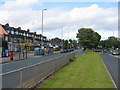


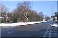
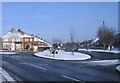
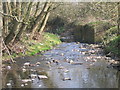
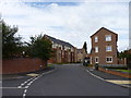
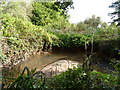
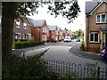

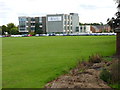
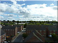
83 photos from this area
Area Information
Key information about the B31 5DR including its size, population, and administrative classification.
- Area Type
- Postcode
- Area Size
- 1.0 hectares
- Population
- 1689
- Population Density
- 6004 people/km²
House Prices in B31 5DR
25
Properties
£217,175
Average Sold Price
£56,000
Lowest Price
£370,000
Highest Price
Showing 25 properties
| Address | Type | Beds | Baths | Last Sale Price | Last Sale Date | |
|---|---|---|---|---|---|---|
| 61 Bodenham Road, Birmingham, B31 5DR | Detached | 3 | 1 | £370,000 | Mar 2025 | |
| 89 Bodenham Road, Birmingham, B31 5DR | Semi-detached | 3 | 1 | £250,000 | Nov 2023 | |
| 65 Bodenham Road, Birmingham, B31 5DR | Retail | 3 | 1 | £303,000 | Mar 2022 | |
| 81 Bodenham Road, Birmingham, B31 5DR | Semi-detached | 3 | 1 | £350,000 | Jan 2022 | |
| 63 Bodenham Road, Birmingham, B31 5DR | house | 3 | - | £340,000 | Dec 2021 | |
| 73 Bodenham Road, Birmingham, B31 5DR | house | - | - | £280,000 | Oct 2021 | |
| 95 Bodenham Road, Birmingham, B31 5DR | Semi-detached | 3 | - | £218,000 | Apr 2021 | |
| 55 Bodenham Road, Birmingham, B31 5DR | Detached | 3 | 1 | £280,000 | Jan 2020 | |
| 77 Bodenham Road, Birmingham, B31 5DR | Semi-detached | 4 | - | £261,000 | Sep 2018 | |
| 71 Bodenham Road, Birmingham, B31 5DR | Semi-detached | 3 | - | £165,000 | Apr 2014 |
Page 1 of 3
Energy Efficiency in B31 5DR
Amenities
Schools
| Rank | School | Type | Entry gender | Ages |
|---|
Explore more schools in this area
Go to Schools tabDemographics
Household Size
Family (3-5 people)
most common
Accommodation Type
Houses
most common
Tenure
80
majority
Ethnic Group
White
most common
Religion
N/A
most common
Household Composition
N/A
most common
Age
47
median
Adults (30-64 years)
most common
Household Deprivation
N/A
with no deprivation
NS-SEC
37
in Lower managerial occupations
Explore more demographic insights in this area
Go to Demographics tabPlanning
Planning Constraints
- Flood RiskPremium
- Ramsar Wetland SitesPremium
- Area of Outstanding Natural BeautyPremium
- Protected Nature ReservePremium
- Protected WoodlandPremium