Area Overview for B31 5AB
Photos of B31 5AB
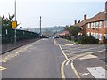

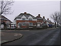
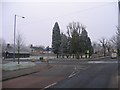
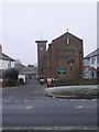
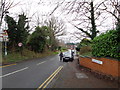
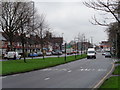
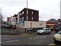
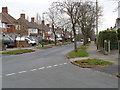
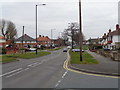
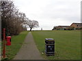
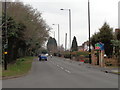
45 photos from this area
Area Information
Key information about the B31 5AB including its size, population, and administrative classification.
- Area Type
- Postcode
- Area Size
- 2.2 hectares
- Population
- 1517
- Population Density
- 4310 people/km²
House Prices in B31 5AB
22
Properties
£144,243
Average Sold Price
£43,250
Lowest Price
£445,000
Highest Price
Showing 22 properties
| Address | Type | Beds | Baths | Last Sale Price | Last Sale Date | |
|---|---|---|---|---|---|---|
| 51 Frankley Beeches Road, Weoley, Birmingham, B31 5AB | Retail | 5 | 2 | £445,000 | Jun 2022 | |
| 55 Frankley Beeches Road, Weoley, Birmingham, B31 5AB | Semi-detached | 3 | - | £185,000 | May 2020 | |
| 77 Frankley Beeches Road, Weoley, Birmingham, B31 5AB | Detached | 3 | 1 | £204,000 | Dec 2016 | |
| 79 Frankley Beeches Road, Weoley, Birmingham, B31 5AB | Bungalow | 2 | - | £109,650 | Sep 2015 | |
| 21 Frankley Beeches Road, Weoley, Birmingham, B31 5AB | house | - | - | £102,000 | Mar 2015 | |
| 75 Frankley Beeches Road, Weoley, Birmingham, B31 5AB | Semi-detached | - | - | £157,000 | Sep 2007 | |
| 73 Frankley Beeches Road, Weoley, Birmingham, B31 5AB | Semi-detached | 5 | 1 | £151,000 | Dec 2006 | |
| 47 Frankley Beeches Road, Weoley, Birmingham, B31 5AB | Semi-detached | - | - | £125,000 | Aug 2006 | |
| 23 Frankley Beeches Road, Weoley, Birmingham, B31 5AB | house | - | - | £75,000 | May 2006 | |
| 41 Frankley Beeches Road, Weoley, Birmingham, B31 5AB | Semi-detached | - | - | £95,000 | Jan 2006 |
Page 1 of 3
Energy Efficiency in B31 5AB
Amenities
Schools
| Rank | School | Type | Entry gender | Ages |
|---|
Explore more schools in this area
Go to Schools tabDemographics
Household Size
Two person
most common
Accommodation Type
Houses
most common
Tenure
81
majority
Ethnic Group
White
most common
Religion
N/A
most common
Household Composition
N/A
most common
Age
47
median
Adults (30-64 years)
most common
Household Deprivation
N/A
with no deprivation
NS-SEC
34
in Lower managerial occupations
Explore more demographic insights in this area
Go to Demographics tabPlanning
Planning Constraints
- Flood RiskPremium
- Ramsar Wetland SitesPremium
- Area of Outstanding Natural BeautyPremium
- Protected Nature ReservePremium
- Protected WoodlandPremium