Area Overview for B31 4TD
Photos of B31 4TD
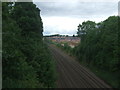
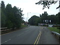
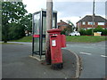
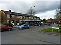
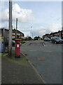
25 photos from this area
Area Information
Key information about the B31 4TD including its size, population, and administrative classification.
- Area Type
- Postcode
- Area Size
- 12.3 hectares
- Population
- 1612
- Population Density
- 262 people/km²
House Prices in B31 4TD
28
Properties
£166,389
Average Sold Price
£86,000
Lowest Price
£270,000
Highest Price
Showing 28 properties
| Address | Type | Beds | Baths | Last Sale Price | Last Sale Date | |
|---|---|---|---|---|---|---|
| 180 Nuthurst Road, Birmingham, B31 4TD | Semi-detached | 2 | 1 | £210,000 | Jul 2024 | |
| 184 Nuthurst Road, Birmingham, B31 4TD | Semi-detached | 3 | 1 | £270,000 | Jan 2022 | |
| 192 Nuthurst Road, Birmingham, B31 4TD | Semi-detached | 3 | 1 | £219,950 | Feb 2020 | |
| 204 Nuthurst Road, Birmingham, B31 4TD | Semi-detached | 3 | 1 | £225,500 | Nov 2019 | |
| 170 Nuthurst Road, Birmingham, B31 4TD | Semi-detached | 3 | - | £180,000 | Jul 2019 | |
| 152 Nuthurst Road, Birmingham, B31 4TD | Semi-detached | 3 | 1 | £205,000 | Apr 2019 | |
| 166 Nuthurst Road, Birmingham, B31 4TD | Semi-detached | 3 | - | £157,500 | Jan 2016 | |
| 182 Nuthurst Road, Birmingham, B31 4TD | house | 2 | - | £133,500 | Nov 2014 | |
| 200 Nuthurst Road, Birmingham, B31 4TD | Semi-detached | - | - | £135,000 | Jun 2012 | |
| 178 Nuthurst Road, Birmingham, B31 4TD | house | 2 | - | £115,000 | Feb 2012 |
Page 1 of 3
Energy Efficiency in B31 4TD
Amenities
Schools
| Rank | School | Type | Entry gender | Ages |
|---|
Explore more schools in this area
Go to Schools tabDemographics
Household Size
Two person
most common
Accommodation Type
Houses
most common
Tenure
92
majority
Ethnic Group
White
most common
Religion
N/A
most common
Household Composition
N/A
most common
Age
47
median
Adults (30-64 years)
most common
Household Deprivation
N/A
with no deprivation
NS-SEC
56
in Lower managerial occupations
Explore more demographic insights in this area
Go to Demographics tabPlanning
Planning Constraints
- Flood RiskPremium
- Ramsar Wetland SitesPremium
- Area of Outstanding Natural BeautyPremium
- Protected Nature ReservePremium
- Protected WoodlandPremium