Area Overview for B31 4NA
Photos of B31 4NA
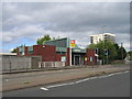
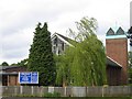

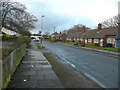
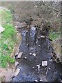


100 photos from this area
Area Information
Key information about the B31 4NA including its size, population, and administrative classification.
- Area Type
- Postcode
- Area Size
- 6744 m²
- Population
- 1297
- Population Density
- 2050 people/km²
House Prices in B31 4NA
26
Properties
£128,897
Average Sold Price
£39,950
Lowest Price
£200,000
Highest Price
Showing 26 properties
| Address | Type | Beds | Baths | Last Sale Price | Last Sale Date | |
|---|---|---|---|---|---|---|
| 108 Thurlestone Road, Birmingham, B31 4NA | Semi-detached | 3 | 1 | £190,000 | Jan 2025 | |
| 88 Thurlestone Road, Birmingham, B31 4NA | Terraced | 3 | 1 | £198,500 | Dec 2024 | |
| 106 Thurlestone Road, Birmingham, B31 4NA | Semi-detached | 3 | 1 | £200,000 | Apr 2023 | |
| 94 Thurlestone Road, Birmingham, B31 4NA | Terraced | 3 | 1 | £187,500 | Apr 2022 | |
| 70 Thurlestone Road, Birmingham, B31 4NA | Semi-detached | 3 | 1 | £176,000 | Sep 2021 | |
| 116 Thurlestone Road, Birmingham, B31 4NA | Terraced | 2 | 1 | £153,000 | Aug 2018 | |
| 86 Thurlestone Road, Birmingham, B31 4NA | Terraced | 3 | 1 | £161,000 | Oct 2017 | |
| 90 Thurlestone Road, Birmingham, B31 4NA | Terraced | 3 | 1 | £125,000 | Aug 2017 | |
| 98 Thurlestone Road, Birmingham, B31 4NA | house | - | - | £103,000 | Jun 2015 | |
| 104 Thurlestone Road, Birmingham, B31 4NA | house | 2 | - | £105,000 | Jun 2014 |
Page 1 of 3
Energy Efficiency in B31 4NA
Amenities
Schools
| Rank | School | Type | Entry gender | Ages |
|---|
Explore more schools in this area
Go to Schools tabDemographics
Household Size
One person
most common
Accommodation Type
Flats
most common
Tenure
66
majority
Ethnic Group
White
most common
Religion
N/A
most common
Household Composition
N/A
most common
Age
47
median
Adults (30-64 years)
most common
Household Deprivation
N/A
with no deprivation
NS-SEC
31
in Lower managerial occupations
Explore more demographic insights in this area
Go to Demographics tabPlanning
Planning Constraints
- Flood RiskPremium
- Ramsar Wetland SitesPremium
- Area of Outstanding Natural BeautyPremium
- Protected Nature ReservePremium
- Protected WoodlandPremium