Area Overview for B31 4LG
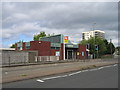
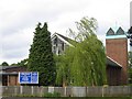
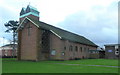
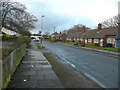
Photos of B31 4LG


Area Information
B31 4LG is a small residential postcode cluster in south-west Birmingham, nestled within the broader West Heath area. With a population of 1,297, it sits on former heathland that transitioned from farmland to a post-war housing development. The area is defined by its proximity to Longbridge, Northfield, and Kings Norton, with a mix of 1940s prefab homes and later permanent estates. Daily life here is shaped by its role as a commuter suburb, with many residents working in central Birmingham. The postcode’s small size means it is a tightly knit community, though its character is influenced by its history as a dormitory area for industrial workers. Key landmarks include Longbridge railway station, West Heath Community Centre, and nearby schools like Bournville College. While it lacks major industry, the area offers a quiet, residential atmosphere with access to nearby amenities and transport links. Its location on the edge of Birmingham provides a balance between suburban calm and urban connectivity.
- Area Type
- Postcode
- Area Size
- Not available
- Population
- 1297
- Population Density
- 2050 people/km²
The property market in B31 4LG is dominated by flats, with 66% of homes owner-occupied. This suggests a mix of long-term residents and a smaller proportion of rental properties. The concentration of flats may reflect the area’s post-war housing stock, which often includes purpose-built blocks. As a small postcode cluster, the housing stock is limited in scale, meaning buyers may need to consider nearby areas for more options. The high home ownership rate indicates a stable market, though the absence of larger family homes could be a limitation for those seeking more space. The area’s role as a commuter suburb means properties are often viewed as investment opportunities for those working in Birmingham’s central districts. Buyers should note the compact nature of the postcode and its proximity to transport links, which may enhance its appeal for those prioritising convenience over expansive living space.
House Prices in B31 4LG
No properties found in this postcode.
Energy Efficiency in B31 4LG
The lifestyle in B31 4LG is shaped by its mix of residential tranquillity and accessible amenities. Nearby retail options include M&S Longbridge, Sainsburys Longbridge, and Morrisons Daily, offering everyday shopping needs. The Edgbaston Village metro stop connects residents to Birmingham’s cultural and commercial hubs. Parks such as West Heath Park and Cofton Park provide green spaces for recreation, while the West Heath Community Centre offers social and leisure activities. The area’s historical roots are visible in landmarks like the old railway workers’ cottages on Station Road and The Man On The Moon pub. This blend of suburban comfort and nearby urban access creates a balanced lifestyle, suitable for those seeking convenience without sacrificing a sense of community.
Amenities
Schools
The nearest school to B31 4LG is Bournville College of Further Education, a sixth-form institution. No primary or secondary schools are listed in the data, which means families with younger children may need to look further afield. The presence of a sixth-form college suggests the area caters to older students, possibly those commuting from surrounding suburbs. For primary education, nearby schools such as Cofton Primary and West Heath Primary are mentioned in historical context but are not explicitly tied to B31 4LG. This lack of detailed school information may be a consideration for families prioritising proximity to educational institutions. The absence of Ofsted ratings or specific school performance data means further research would be needed to assess the quality of local education options.
| Rank | School | Type | Entry gender | Ages |
|---|
Explore more schools in this area
Go to Schools tabDemographics
The population of B31 4LG is 1,297, with a median age of 47. The majority of residents are adults aged 30-64, reflecting a mature, stable community. Home ownership rates are 66%, indicating a strong presence of long-term residents. The primary accommodation type is flats, suggesting a mix of purpose-built housing and converted properties. The predominant ethnic group is White, though specific diversity statistics are not provided. The age profile suggests a community focused on family stability and established careers, with limited representation of younger or older demographics. This profile aligns with the area’s history as a post-war housing development, where many residents have lived for decades. The lack of younger households may impact local schools and amenities, though the presence of a sixth-form college nearby indicates some educational provision for older students.
Household Size
Accommodation Type
Tenure
Ethnic Group
Religion
Household Composition
Age
Household Deprivation
NS-SEC
Explore more demographic insights in this area
Go to Demographics tabPlanning
Planning Constraints
- Flood RiskPremium
- Ramsar Wetland SitesPremium
- Area of Outstanding Natural BeautyPremium
- Protected Nature ReservePremium
- Protected WoodlandPremium