Area Overview for B31 4JA
Photos of B31 4JA


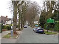
100 photos from this area
Area Information
Key information about the B31 4JA including its size, population, and administrative classification.
- Area Type
- Postcode
- Area Size
- 5530 m²
- Population
- 1608
- Population Density
- 4295 people/km²
House Prices in B31 4JA
13
Properties
£159,889
Average Sold Price
£60,000
Lowest Price
£230,000
Highest Price
Showing 13 properties
| Address | Type | Beds | Baths | Last Sale Price | Last Sale Date | |
|---|---|---|---|---|---|---|
| 77 Central Avenue, Birmingham, B31 4JA | Detached | 2 | 1 | £200,000 | Apr 2025 | |
| 63 Central Avenue, Birmingham, B31 4JA | Bungalow | 2 | 1 | £192,000 | Nov 2024 | |
| 79 Central Avenue, Birmingham, B31 4JA | Bungalow | 3 | 1 | £230,000 | Nov 2023 | |
| 61 Central Avenue, Birmingham, B31 4JA | Semi-detached | 4 | 1 | £225,000 | Aug 2019 | |
| 69 Central Avenue, Birmingham, B31 4JA | Bungalow | - | - | £140,000 | Feb 2017 | |
| 65 Central Avenue, Birmingham, B31 4JA | Bungalow | 2 | - | £142,000 | Dec 2013 | |
| 75 Central Avenue, Birmingham, B31 4JA | house | 3 | - | £117,500 | Sep 2012 | |
| 81 Central Avenue, Birmingham, B31 4JA | Bungalow | 3 | - | £132,500 | Apr 2012 | |
| 71 Central Avenue, Birmingham, B31 4JA | Bungalow | - | - | £60,000 | Apr 2001 | |
| 83 Central Avenue, Birmingham, B31 4JA | Bungalow | - | - | - | - |
Page 1 of 2
Energy Efficiency in B31 4JA
Amenities
Schools
| Rank | School | Type | Entry gender | Ages |
|---|
Explore more schools in this area
Go to Schools tabDemographics
Household Size
Two person
most common
Accommodation Type
Houses
most common
Tenure
66
majority
Ethnic Group
White
most common
Religion
N/A
most common
Household Composition
N/A
most common
Age
47
median
Adults (30-64 years)
most common
Household Deprivation
N/A
with no deprivation
NS-SEC
26
in Lower managerial occupations
Explore more demographic insights in this area
Go to Demographics tabPlanning
Planning Constraints
- Flood RiskPremium
- Ramsar Wetland SitesPremium
- Area of Outstanding Natural BeautyPremium
- Protected Nature ReservePremium
- Protected WoodlandPremium