Area Overview for B31 4EF
Photos of B31 4EF


Area Information
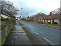
B31 4EF is a small residential postcode in south-west Birmingham, part of the Longbridge & West Heath ward. With a population of 1,815, it reflects a suburban character shaped by post-war housing developments on former heathland. The area lies between Kings Norton, Northfield, and Longbridge, with a mix of residential clusters and limited industrial activity. Historically, it was part of Worcestershire before becoming part of Birmingham in 1911. Today, it serves as a dormitory suburb for central Birmingham, with many residents commuting to the city for work. The area’s compact size means it is tightly integrated with nearby towns, offering a balance of quiet residential living and proximity to urban amenities. Its character is defined by older housing stock, including post-war flats and historic features like the old nailers cottage in Turves Green. While not a commercial hub, B31 4EF benefits from nearby transport links and community-focused facilities, making it a practical choice for those seeking a settled, low-maintenance lifestyle.
- Area Type
- Postcode
- Area Size
- Not available
- Population
- 1815
- Population Density
- 5164 people/km²
B31 4EF’s property market is characterised by a 34% home ownership rate, indicating that most residents rent rather than own their homes. The accommodation type is predominantly flats, which aligns with the area’s post-war housing developments and limited availability of larger properties. This suggests a market focused on smaller, older units, often in multi-occupancy buildings. For buyers, this means opportunities are limited to specific properties within the small postcode area, with few detached or semi-detached homes available. The rental market may offer more choice, but affordability could be a concern given the age of the housing stock. Prospective buyers should consider the lack of newer developments and the potential for maintenance costs in older flats. The immediate surroundings, including parts of Longbridge and West Heath, may offer broader options, but B31 4EF itself remains a niche market.
House Prices in B31 4EF
No properties found in this postcode.
Energy Efficiency in B31 4EF
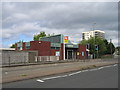
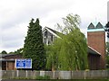
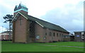
Residents of B31 4EF have access to essential amenities within practical reach, including retail options like Morrisons Daily, Sainsburys Longbridge, and other local stores. The area’s proximity to Longbridge railway station and other nearby stations enhances mobility, while the Edgbaston Village metro station offers additional transport links. Parks and community spaces such as West Heath Park and Cofton Park provide recreational opportunities, though specific details on their condition or facilities are not included. The presence of schools, churches, and community centres like West Heath Community Centre suggests a focus on local services and social cohesion. While the area lacks large commercial hubs, its compact size ensures convenience for daily needs. The mix of retail, transport, and green spaces supports a balanced lifestyle, though those seeking more extensive leisure options may need to travel to nearby towns.
Amenities
Schools
B31 4EF is served by several primary schools, including Albert Bradbeer Junior School, Albert Bradbeer Infant and Nursery Community School, Turves Green Boys’ School, Albert Bradbeer Primary, and Albert Bradbeer Primary Academy, which holds an Ofsted rating of ‘good’. These institutions cater to younger children, with a focus on primary education. The concentration of primary schools suggests the area is well-suited for families with young dependents, though no secondary schools are listed. The presence of multiple schools in close proximity reduces travel time for parents and ensures a range of educational options. However, the absence of secondary school data means families may need to consider commuting for older children. The ‘good’ Ofsted rating at Albert Bradbeer Primary Academy indicates a reliable standard of education, which could be a key factor for homebuyers prioritising school quality.
| Rank | School | Type | Entry gender | Ages |
|---|
Explore more schools in this area
Go to Schools tabDemographics
The population of B31 4EF is 1,815, with a median age of 47, indicating a mature demographic. The most common age range is adults aged 30–64, suggesting a community of established residents rather than a family-centric area. Home ownership here is relatively low at 34%, with flats being the predominant accommodation type. This reflects a rental market skewed toward older properties, likely influenced by the area’s post-war housing stock. The predominant ethnic group is White, though no specific diversity statistics are provided. The age profile and home ownership rate suggest a stable, long-term resident base, with fewer young families or recent migrants. The absence of detailed deprivation data means quality of life factors like access to services or employment opportunities are not quantified, but the presence of schools and transport links implies basic needs are met.
Household Size
Accommodation Type
Tenure
Ethnic Group
Religion
Household Composition
Age
Household Deprivation
NS-SEC
Explore more demographic insights in this area
Go to Demographics tabPlanning
Planning Constraints
- Flood RiskPremium
- Ramsar Wetland SitesPremium
- Area of Outstanding Natural BeautyPremium
- Protected Nature ReservePremium
- Protected WoodlandPremium