Area Overview for B31 4BS
Photos of B31 4BS
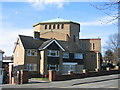

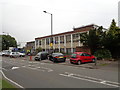
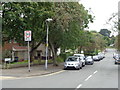

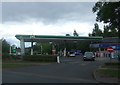


21 photos from this area
Area Information
Key information about the B31 4BS including its size, population, and administrative classification.
- Area Type
- Postcode
- Area Size
- 1.5 hectares
- Population
- 1815
- Population Density
- 5164 people/km²
House Prices in B31 4BS
16
Properties
£202,375
Average Sold Price
£107,000
Lowest Price
£375,000
Highest Price
Showing 16 properties
| Address | Type | Beds | Baths | Last Sale Price | Last Sale Date | |
|---|---|---|---|---|---|---|
| 205 Turves Green, Birmingham, B31 4BS | Terraced | 3 | 1 | £240,000 | Sep 2023 | |
| 303 Turves Green, Birmingham, B31 4BS | Terraced | 3 | - | £185,000 | Feb 2023 | |
| 297 Turves Green, Birmingham, B31 4BS | Semi-detached | 3 | 1 | £220,000 | Apr 2022 | |
| 299 Turves Green, Birmingham, B31 4BS | Retail | 3 | 1 | £200,000 | Mar 2022 | |
| 279 Turves Green, Birmingham, B31 4BS | Detached | 4 | - | £375,000 | Aug 2021 | |
| 203 Turves Green, Birmingham, B31 4BS | house | - | - | £168,000 | Jul 2021 | |
| 201 Turves Green, Birmingham, B31 4BS | house | 3 | - | £107,000 | Oct 2008 | |
| 285 Turves Green, Birmingham, B31 4BS | Semi-detached | - | - | £124,000 | Jul 2004 | |
| 211 Turves Green, Birmingham, B31 4BS | undefined | - | - | - | - | |
| 305 Turves Green, Birmingham, B31 4BS | Bungalow | - | - | - | - |
Page 1 of 2
Energy Efficiency in B31 4BS
Amenities
Schools
| Rank | School | Type | Entry gender | Ages |
|---|
Explore more schools in this area
Go to Schools tabDemographics
Household Size
One person
most common
Accommodation Type
Flats
most common
Tenure
34
majority
Ethnic Group
White
most common
Religion
N/A
most common
Household Composition
N/A
most common
Age
47
median
Adults (30-64 years)
most common
Household Deprivation
N/A
with no deprivation
NS-SEC
16
in Lower managerial occupations
Explore more demographic insights in this area
Go to Demographics tabPlanning
Planning Constraints
- Flood RiskPremium
- Ramsar Wetland SitesPremium
- Area of Outstanding Natural BeautyPremium
- Protected Nature ReservePremium
- Protected WoodlandPremium