Area Overview for B31 3XA
Photos of B31 3XA
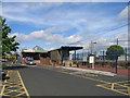

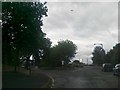

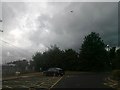
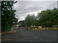
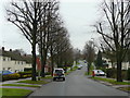
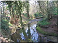
65 photos from this area
Area Information
Key information about the B31 3XA including its size, population, and administrative classification.
- Area Type
- Postcode
- Area Size
- 5214 m²
- Population
- 1443
- Population Density
- 5635 people/km²
House Prices in B31 3XA
15
Properties
£138,027
Average Sold Price
£46,000
Lowest Price
£295,000
Highest Price
Showing 15 properties
| Address | Type | Beds | Baths | Last Sale Price | Last Sale Date | |
|---|---|---|---|---|---|---|
| 24 Rea Valley Drive, Birmingham, B31 3XA | Semi-detached | 2 | 1 | £200,000 | Dec 2024 | |
| 8 Rea Valley Drive, Birmingham, B31 3XA | Retail | 2 | 1 | £225,000 | Oct 2022 | |
| 20 Rea Valley Drive, Birmingham, B31 3XA | Retail | 3 | 2 | £295,000 | Sep 2022 | |
| 14 Rea Valley Drive, Birmingham, B31 3XA | Bungalow | 3 | 1 | £229,000 | Feb 2021 | |
| 6 Rea Valley Drive, Birmingham, B31 3XA | Semi-detached | 2 | - | £160,000 | Oct 2017 | |
| 4 Rea Valley Drive, Birmingham, B31 3XA | Bungalow | 2 | - | £180,000 | Apr 2017 | |
| 34 Rea Valley Drive, Birmingham, B31 3XA | Semi-detached | 2 | 1 | £114,000 | Jul 2014 | |
| 28 Rea Valley Drive, Birmingham, B31 3XA | Semi-detached | - | - | £109,950 | May 2003 | |
| 26 Rea Valley Drive, Birmingham, B31 3XA | Semi-detached | - | - | £85,500 | Jul 2002 | |
| 32 Rea Valley Drive, Birmingham, B31 3XA | Semi-detached | - | - | £50,000 | Jul 1999 |
Page 1 of 2
Energy Efficiency in B31 3XA
Amenities
Schools
| Rank | School | Type | Entry gender | Ages |
|---|
Explore more schools in this area
Go to Schools tabDemographics
Household Size
Two person
most common
Accommodation Type
Houses
most common
Tenure
77
majority
Ethnic Group
White
most common
Religion
N/A
most common
Household Composition
N/A
most common
Age
47
median
Adults (30-64 years)
most common
Household Deprivation
N/A
with no deprivation
NS-SEC
36
in Lower managerial occupations
Explore more demographic insights in this area
Go to Demographics tabPlanning
Planning Constraints
- Flood RiskPremium
- Ramsar Wetland SitesPremium
- Area of Outstanding Natural BeautyPremium
- Protected Nature ReservePremium
- Protected WoodlandPremium