Area Overview for B31 3UZ
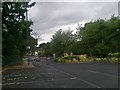
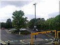
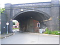
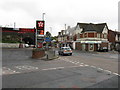
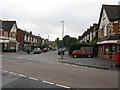
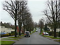
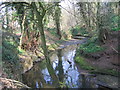
Photos of B31 3UZ


Area Information
B31 3UZ is a small residential postcode cluster in England, part of Birmingham’s southern suburbs. With a population of 1,818, it sits at the edge of historical Worcestershire, now integrated into modern Birmingham. The area’s character is shaped by its proximity to King’s Norton and Northfield, both of which have roots as trading centres and industrial hubs. Residents benefit from a mix of historical and contemporary infrastructure, including the Worcester and Birmingham Canal, which once facilitated transport between Birmingham and the River Severn. The postcode is served by multiple railway stations, linking it to broader Birmingham and beyond. Daily life here balances suburban tranquillity with access to urban amenities, though the area remains relatively compact. Its small size means residents are likely to know their neighbours, and the community is defined by a median age of 47, with many households headed by adults aged 30–64. The presence of houses as the primary accommodation type suggests a stable, family-oriented environment. For buyers, B31 3UZ offers a blend of affordability and practicality, though its limited size means proximity to nearby areas is key for expanded opportunities.
- Area Type
- Postcode
- Area Size
- Not available
- Population
- 1818
- Population Density
- 6215 people/km²
The property market in B31 3UZ is characterised by a 50% home ownership rate, with houses forming the predominant accommodation type. This suggests a mix of owner-occupied and rental properties, though the exact proportion of rentals is not specified. The presence of houses indicates a focus on family homes or larger properties, which may appeal to buyers seeking space or stability. Given the area’s small size, the housing stock is likely limited, meaning buyers may need to consider nearby postcodes for more options. The 50% ownership rate also implies that a significant portion of the housing stock is rented, potentially offering opportunities for investors. However, the lack of detailed data on property prices or trends means the market’s affordability and growth potential remain unclear. For first-time buyers, the area’s compact nature may require careful consideration of proximity to essential services and transport links.
House Prices in B31 3UZ
No properties found in this postcode.
Energy Efficiency in B31 3UZ
Residents of B31 3UZ have access to a range of nearby amenities, including retail outlets like Co-op Longbridge, Aldi Northfield, and Sainsburys Northfield. These shops provide essential shopping options within practical reach. The area is also served by multiple railway stations, including Northfield, Longbridge, and Kings Norton, offering convenient transport links. For urban connectivity, metro stops such as Edgbaston Village, Centenary Square, and Town Hall are within reach, facilitating access to Birmingham’s central districts. While the data does not mention parks or leisure facilities, the historical presence of the Worcester and Birmingham Canal suggests potential for recreational use. The mix of retail, rail, and metro options supports a lifestyle that balances suburban convenience with urban accessibility, though further details on leisure amenities remain absent.
Amenities
Schools
The only school explicitly listed near B31 3UZ is West Heath Nursery School, which provides early years education. No primary or secondary schools are named in the data, which may limit options for families with older children. The presence of a nursery suggests the area caters to young families, though parents may need to look beyond the immediate postcode for comprehensive schooling. The absence of detailed Ofsted ratings or school performance data means it is difficult to assess the quality of education available. For buyers prioritising schools, this could be a consideration, as the area’s limited educational infrastructure may require reliance on nearby towns like Northfield or Birmingham city centre. The mix of school types is currently unbalanced, with no secondary education options directly accessible within the postcode.
| Rank | School | Type | Entry gender | Ages |
|---|
Explore more schools in this area
Go to Schools tabDemographics
The community in B31 3UZ is predominantly composed of adults aged 30–64, with a median age of 47. This suggests a mature, established population, likely with long-term ties to the area. Home ownership sits at 50%, indicating a balance between owner-occupied properties and rental homes. The accommodation type is primarily houses, which may reflect a preference for family homes or larger living spaces. The predominant ethnic group is White, though no specific data on diversity or deprivation levels is provided. The age profile implies a stable demographic, with fewer young families or retirees compared to other areas. This mix may influence local services and amenities, which are tailored to the needs of middle-aged residents. The absence of detailed diversity statistics means the community’s cultural makeup remains less defined in the data. For buyers, the demographic profile suggests a low turnover of properties and a focus on long-term residency.
Household Size
Accommodation Type
Tenure
Ethnic Group
Religion
Household Composition
Age
Household Deprivation
NS-SEC
Explore more demographic insights in this area
Go to Demographics tabPlanning
Planning Constraints
- Flood RiskPremium
- Ramsar Wetland SitesPremium
- Area of Outstanding Natural BeautyPremium
- Protected Nature ReservePremium
- Protected WoodlandPremium