Area Overview for B31 3RT
Photos of B31 3RT
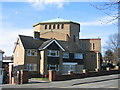

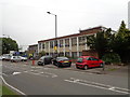
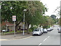

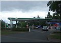


21 photos from this area
Area Information
Key information about the B31 3RT including its size, population, and administrative classification.
- Area Type
- Postcode
- Area Size
- 7134 m²
- Population
- 1774
- Population Density
- 5326 people/km²
House Prices in B31 3RT
16
Properties
£102,250
Average Sold Price
£40,000
Lowest Price
£189,000
Highest Price
Showing 16 properties
| Address | Type | Beds | Baths | Last Sale Price | Last Sale Date | |
|---|---|---|---|---|---|---|
| 232 Fairfax Road, Northfield, Birmingham, B31 3RT | Terraced | 3 | 1 | £189,000 | Apr 2025 | |
| 228 Fairfax Road, Northfield, Birmingham, B31 3RT | Terraced | 3 | 1 | £129,000 | May 2016 | |
| 222 Fairfax Road, Northfield, Birmingham, B31 3RT | Terraced | - | - | £51,000 | Aug 1999 | |
| 230 Fairfax Road, Northfield, Birmingham, B31 3RT | house | - | - | £40,000 | Dec 1996 | |
| Flat, The Cavalier, Fairfax Road, Northfield, Birmingham, B31 3RT | Flat | - | - | - | - | |
| 244 Fairfax Road, Northfield, Birmingham, B31 3RT | house | - | - | - | - | |
| 216 Fairfax Road, Northfield, Birmingham, B31 3RT | house | - | - | - | - | |
| 234 Fairfax Road, Northfield, Birmingham, B31 3RT | house | - | - | - | - | |
| 218 Fairfax Road, Northfield, Birmingham, B31 3RT | Terraced | - | - | - | - | |
| 226 Fairfax Road, Northfield, Birmingham, B31 3RT | Semi-detached | - | - | - | - |
Page 1 of 2
Energy Efficiency in B31 3RT
Amenities
Schools
| Rank | School | Type | Entry gender | Ages |
|---|
Explore more schools in this area
Go to Schools tabDemographics
Household Size
One person
most common
Accommodation Type
Houses
most common
Tenure
48
majority
Ethnic Group
White
most common
Religion
N/A
most common
Household Composition
N/A
most common
Age
47
median
Adults (30-64 years)
most common
Household Deprivation
N/A
with no deprivation
NS-SEC
19
in Lower managerial occupations
Explore more demographic insights in this area
Go to Demographics tabPlanning
Planning Constraints
- Flood RiskPremium
- Ramsar Wetland SitesPremium
- Area of Outstanding Natural BeautyPremium
- Protected Nature ReservePremium
- Protected WoodlandPremium