Area Overview for B31 3RF
Photos of B31 3RF
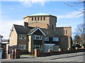

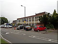
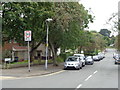

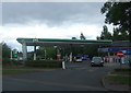


21 photos from this area
Area Information
Key information about the B31 3RF including its size, population, and administrative classification.
- Area Type
- Postcode
- Area Size
- 1.0 hectares
- Population
- 1815
- Population Density
- 5164 people/km²
House Prices in B31 3RF
37
Properties
£98,806
Average Sold Price
£36,950
Lowest Price
£184,000
Highest Price
Showing 37 properties
| Address | Type | Beds | Baths | Last Sale Price | Last Sale Date | |
|---|---|---|---|---|---|---|
| 67 Clee Road, Birmingham, B31 3RF | house | 3 | - | £184,000 | Apr 2024 | |
| 74 Clee Road, Birmingham, B31 3RF | Maisonette | 2 | 1 | £105,000 | Nov 2020 | |
| 79 Clee Road, Birmingham, B31 3RF | Terraced | 3 | 1 | £135,000 | Sep 2020 | |
| 81 Clee Road, Birmingham, B31 3RF | Terraced | 3 | 1 | £146,500 | Apr 2020 | |
| 38 Clee Road, Birmingham, B31 3RF | Maisonette | 2 | 1 | £95,500 | Jan 2020 | |
| 78 Clee Road, Birmingham, B31 3RF | Semi-detached | 3 | - | £129,000 | Apr 2018 | |
| 88 Clee Road, Birmingham, B31 3RF | Detached | 2 | 1 | £152,500 | Dec 2017 | |
| 70 Clee Road, Birmingham, B31 3RF | Flat | 2 | 1 | £97,000 | Sep 2017 | |
| 86 Clee Road, Birmingham, B31 3RF | Terraced | 3 | 1 | £106,000 | Aug 2015 | |
| 58 Clee Road, Birmingham, B31 3RF | Maisonette | 2 | 1 | £80,000 | Sep 2014 |
Page 1 of 4
Energy Efficiency in B31 3RF
Amenities
Schools
| Rank | School | Type | Entry gender | Ages |
|---|
Explore more schools in this area
Go to Schools tabDemographics
Household Size
One person
most common
Accommodation Type
Flats
most common
Tenure
34
majority
Ethnic Group
White
most common
Religion
N/A
most common
Household Composition
N/A
most common
Age
47
median
Adults (30-64 years)
most common
Household Deprivation
N/A
with no deprivation
NS-SEC
16
in Lower managerial occupations
Explore more demographic insights in this area
Go to Demographics tabPlanning
Planning Constraints
- Flood RiskPremium
- Ramsar Wetland SitesPremium
- Area of Outstanding Natural BeautyPremium
- Protected Nature ReservePremium
- Protected WoodlandPremium