Area Overview for B31 3ER
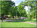
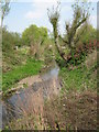
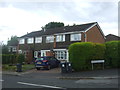
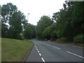
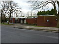
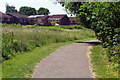
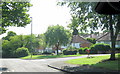
Photos of B31 3ER
Area Information
Living in B31 3ER means inhabiting a compact, densely populated residential cluster in Birmingham’s southern suburbs. The area covers just 1.8 hectares, yet it holds 2,073 residents, translating to a population density of 114,536 people per square kilometre. This small postcode is part of King’s Norton North Ward, historically rooted in Worcestershire before its absorption into Birmingham in 1911. The area’s character is shaped by its industrial past, with the Worcester and Birmingham Canal running nearby, a legacy of 19th-century railway links that spurred growth. Today, B31 3ER is a tight-knit community with a focus on practical living, offering proximity to retail, transport, and schools. Its size means residents are close to amenities, but the high density and limited space suggest a need for efficient use of space. For those seeking a compact, connected environment with historical ties to Birmingham’s expansion, B31 3ER provides a distinct blend of urban convenience and local heritage.
- Area Type
- Postcode
- Area Size
- 1.8 hectares
- Population
- 2073
- Population Density
- 7317 people/km²
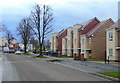
The property market in B31 3ER is characterised by a low home ownership rate of 23%, indicating that the majority of residents are renters rather than homeowners. The accommodation type is predominantly houses, which is unusual in a high-density area, suggesting a mix of larger properties squeezed into limited space. This dynamic points to a rental market where demand outstrips supply, potentially driving up rents but limiting opportunities for buyers seeking long-term investment. The area’s small size—just 1.8 hectares—means housing stock is finite, and competition for available properties is likely intense. For buyers, this suggests a focus on securing a home quickly, with limited scope for property development. The presence of houses may appeal to those prioritising space, but the high population density and small footprint mean proximity to amenities comes at the cost of privacy and room for expansion.
House Prices in B31 3ER
Showing 48 properties
| Address | Type | Beds | Baths | Last Sale Price | Last Sale Date | |
|---|---|---|---|---|---|---|
| 256 Staple Lodge Road, Kings Norton, Birmingham, B31 3ER | house | - | - | £220,000 | Jan 2024 | |
| 228 Staple Lodge Road, Northfield, Birmingham, B31 3ER | house | 3 | 1 | £200,000 | Jan 2023 | |
| 306 Staple Lodge Road, Kings Norton, Birmingham, B31 3ER | Terraced | 2 | 1 | £52,500 | Dec 2022 | |
| 284 Staple Lodge Road, Kings Norton, Birmingham, B31 3ER | Semi-detached | 3 | 1 | £180,000 | Sep 2021 | |
| 226 Staple Lodge Road, Northfield, Birmingham, B31 3ER | Semi-detached | 4 | - | £235,000 | May 2018 | |
| 258 Staple Lodge Road, Kings Norton, Birmingham, B31 3ER | Semi-detached | 3 | - | £156,000 | Oct 2017 | |
| 280 Staple Lodge Road, Kings Norton, Birmingham, B31 3ER | Semi-detached | 3 | 1 | £120,000 | Oct 2016 | |
| 222 Staple Lodge Road, Northfield, Birmingham, B31 3ER | Detached | 4 | 2 | £200,000 | Aug 2015 | |
| 224 Staple Lodge Road, Northfield, Birmingham, B31 3ER | Detached | 3 | 1 | £174,000 | Jul 2015 | |
| 302 Staple Lodge Road, Kings Norton, Birmingham, B31 3ER | house | - | - | £62,000 | Jul 2014 |
Energy Efficiency in B31 3ER
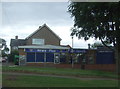
The lifestyle in B31 3ER is defined by proximity to retail, dining, and transport hubs. Nearby shops include Co-op Longbridge, Tesco West, and Spar, providing essential groceries and daily necessities. The area’s rail stations—Northfield, Kings Norton, and Longbridge—offer direct links to Birmingham’s broader network, while metro stops like Edgbaston Village and Centenary Square connect to the city’s central districts. Though the data does not specify parks or leisure facilities, the historical presence of the Worcester and Birmingham Canal suggests potential for recreational walks or water-based activities. The compact layout ensures that amenities are within practical reach, reducing the need for long commutes. However, the high population density may mean limited green spaces or quiet areas for relaxation. For residents prioritising convenience over expansive living, B31 3ER offers a functional, connected lifestyle with immediate access to shopping, transport, and urban hubs.
Amenities
Schools
Residents of B31 3ER have access to several primary schools, including Wychall Farm Junior School, Wychall Farm Infant School, St Thomas Aquinas Catholic School, and Wychall Primary School. Among these, St Thomas Aquinas Catholic School is an academy with a good Ofsted rating, offering a structured educational environment. The concentration of primary schools suggests a focus on early education, though no secondary schools are listed in the data. The presence of multiple primary schools may ease pressure on families seeking places for younger children, but the absence of secondary options could require commuting. The good rating at St Thomas Aquinas indicates at least one reliable option, though parents may need to consider additional factors such as school capacity and catchment areas. For families prioritising primary education, the area’s school mix provides immediate access to multiple choices.
| Rank | School | Type | Entry gender | Ages |
|---|
Explore more schools in this area
Go to Schools tabDemographics
The community in B31 3ER is predominantly middle-aged, with a median age of 47 and the most common age range being adults aged 30–64. This suggests a population focused on established households rather than young families or retirees. Home ownership is low at 23%, indicating that most residents are renters, which may reflect the area’s small size and limited housing stock. The accommodation type is primarily houses, though the high population density—over 100,000 people per square kilometre—implies a mix of compact dwellings. The predominant ethnic group is White, with no specific data on diversity beyond this. The low home ownership rate may impact long-term stability for residents, while the age profile suggests a community prioritising routine over reinvention. For buyers, this demographic profile hints at a market where rental demand is strong, but property values may be constrained by limited supply.
Household Size
Accommodation Type
Tenure
Ethnic Group
Religion
Household Composition
Age
Household Deprivation
NS-SEC
Explore more demographic insights in this area
Go to Demographics tabPlanning
Planning Constraints
- Flood RiskPremium
- Ramsar Wetland SitesPremium
- Area of Outstanding Natural BeautyPremium
- Protected Nature ReservePremium
- Protected WoodlandPremium