Area Overview for B31 3BD
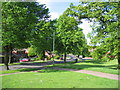
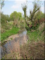
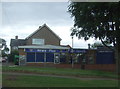
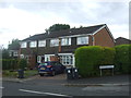
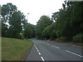
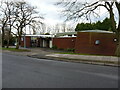
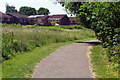
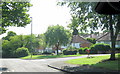
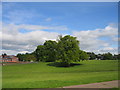
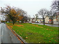
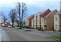
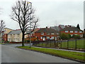
Photos of B31 3BD
Area Information
Living in B31 3BD means being part of a tightly packed residential cluster in England’s West Midlands, where the population of 2,073 is spread across just 4,208 square metres. This density creates a compact, community-oriented environment, though it also means limited space for expansion. The area falls within King’s Norton North Ward, historically part of Worcestershire and now integrated into Birmingham’s southern suburbs. Daily life here is shaped by its proximity to transport networks, including the Worcester and Birmingham Canal, which once fueled industrial growth. The median age of 47 suggests a mature population, with adults aged 30–64 forming the majority. While the area lacks large-scale amenities, its small size ensures a sense of familiarity. Residents benefit from strong broadband connectivity (98/100) and nearby rail links, though crime rates are above average. For those seeking a quiet, tightly knit neighbourhood with practical access to services, B31 3BD offers a mix of challenges and conveniences.
- Area Type
- Postcode
- Area Size
- 4208 m²
- Population
- 2073
- Population Density
- 7317 people/km²
B31 3BD’s property market is characterised by low home ownership (23%) and a focus on houses rather than flats, suggesting a mix of semi-detached or terraced housing. This contrasts with the area’s high population density, which implies smaller homes or multi-family units. The small size of the postcode area (4,208 m²) means housing stock is likely limited, with little room for new developments. For buyers, this creates a niche market where properties may be in demand due to their scarcity. However, the low ownership rate suggests a strong rental market, potentially offering investment opportunities. The predominance of houses over flats may appeal to those seeking traditional family homes, though the high density could mean limited outdoor space. Prospective buyers should consider the area’s compact nature and the challenges of a saturated housing supply.
House Prices in B31 3BD
Showing 27 properties
| Address | Type | Beds | Baths | Last Sale Price | Last Sale Date | |
|---|---|---|---|---|---|---|
| 14 Witley Road, Birmingham, B31 3BD | Semi-detached | - | - | £77,500 | Jun 2008 | |
| Former 1, Witley Road, Birmingham, B31 3BD | Terraced | - | - | - | - | |
| Former 4, Witley Road, Birmingham, B31 3BD | Semi-detached | - | - | - | - | |
| Former 5, Witley Road, Birmingham, B31 3BD | Terraced | - | - | - | - | |
| Former 7, Witley Road, Birmingham, B31 3BD | Terraced | - | - | - | - | |
| Former 8, Witley Road, Birmingham, B31 3BD | Semi-detached | - | - | - | - | |
| Former 2, Witley Road, Birmingham, B31 3BD | Semi-detached | - | - | - | - | |
| Former 3, Witley Road, Birmingham, B31 3BD | Terraced | - | - | - | - | |
| Former 11, Witley Road, Birmingham, B31 3BD | Terraced | - | - | - | - | |
| Former 6, Witley Road, Birmingham, B31 3BD | Semi-detached | - | - | - | - |
Energy Efficiency in B31 3BD
Residents of B31 3BD have access to a range of nearby amenities, including five retail outlets such as Co-op Longbridge, Tesco West, and Spar, ensuring daily shopping needs are met. Rail and metro stations like Northfield Railway Station, Kings Norton Railway Station, and Edgbaston Village provide easy access to Birmingham’s urban centres. While the area lacks large parks or leisure facilities, the proximity to Centenary Square and Town Hall suggests cultural and social hubs are within reach. The compact nature of the postcode means amenities are clustered closely, offering convenience but limited variety. For those valuing proximity to shops, transport, and urban connectivity, B31 3BD provides a practical, though small-scale, lifestyle.
Amenities
Schools
Residents of B31 3BD have access to several primary schools, including Wychall Farm Junior School, Wychall Farm Infant School, St Thomas Aquinas Catholic School, and Wychall Primary School. One of these, St Thomas Aquinas Catholic School, is an academy with an Ofsted rating of ‘good’. The concentration of primary schools within a small area indicates a focus on early education, though the absence of secondary schools means families may need to travel for higher education. The presence of both state and Catholic schools offers diversity in educational options. For parents, the proximity of multiple primary schools is a key advantage, though the lack of secondary schools could be a drawback. The ‘good’ rating at St Thomas Aquinas highlights a reliable option for those prioritising academic quality.
| Rank | School | Type | Entry gender | Ages |
|---|
Explore more schools in this area
Go to Schools tabDemographics
The community in B31 3BD is predominantly White, with 23% of residents owning their homes and the rest likely renting. This low home ownership rate indicates a rental market, which may affect long-term stability for buyers. The area’s population density of 492,598 people per square kilometre is exceptionally high, suggesting tightly packed housing. The median age of 47 and the dominance of adults aged 30–64 suggest a mature demographic, potentially with fewer young families. While the data does not specify income levels or deprivation rates, the high density and limited green space may impact quality of life. The absence of detailed diversity metrics means the community’s composition beyond the predominant White group remains unclear. For buyers, this profile implies a settled, possibly older population, but with limited scope for family-oriented expansion.
Household Size
Accommodation Type
Tenure
Ethnic Group
Religion
Household Composition
Age
Household Deprivation
NS-SEC
Explore more demographic insights in this area
Go to Demographics tabPlanning
Planning Constraints
- Flood RiskPremium
- Ramsar Wetland SitesPremium
- Area of Outstanding Natural BeautyPremium
- Protected Nature ReservePremium
- Protected WoodlandPremium