Area Overview for B31 2UD
Photos of B31 2UD
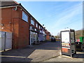
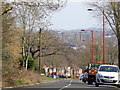
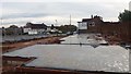
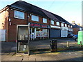
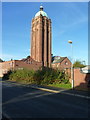
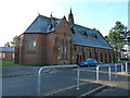
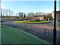
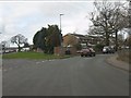
18 photos from this area
Area Information
Key information about the B31 2UD including its size, population, and administrative classification.
- Area Type
- Postcode
- Area Size
- 2.1 hectares
- Population
- 2256
- Population Density
- 3167 people/km²
House Prices in B31 2UD
46
Properties
£106,763
Average Sold Price
£2,400
Lowest Price
£208,000
Highest Price
Showing 46 properties
| Address | Type | Beds | Baths | Last Sale Price | Last Sale Date | |
|---|---|---|---|---|---|---|
| 244 The Roundabout, Birmingham, B31 2UD | Terraced | 3 | 1 | £185,000 | Oct 2024 | |
| 308 The Roundabout, Birmingham, B31 2UD | Terraced | 3 | 1 | £208,000 | May 2024 | |
| 282 The Roundabout, Birmingham, B31 2UD | Terraced | 3 | 1 | £176,000 | May 2024 | |
| 310 The Roundabout, Birmingham, B31 2UD | house | 3 | 1 | £180,000 | Feb 2024 | |
| 248 The Roundabout, Birmingham, B31 2UD | house | 3 | 1 | £190,000 | Jan 2024 | |
| 326 The Roundabout, Birmingham, B31 2UD | Terraced | 3 | 1 | £155,000 | Jun 2021 | |
| 262 The Roundabout, Birmingham, B31 2UD | house | - | - | £130,000 | Jun 2020 | |
| 324 The Roundabout, Birmingham, B31 2UD | Semi-detached | 3 | 1 | £111,500 | Dec 2017 | |
| 246 The Roundabout, Birmingham, B31 2UD | Semi-detached | 3 | 1 | £100,000 | Nov 2017 | |
| 322 The Roundabout, Birmingham, B31 2UD | house | 3 | 1 | £122,000 | Jun 2017 |
Page 1 of 5
Energy Efficiency in B31 2UD
Amenities
Schools
| Rank | School | Type | Entry gender | Ages |
|---|
Explore more schools in this area
Go to Schools tabDemographics
Household Size
Family (3-5 people)
most common
Accommodation Type
Houses
most common
Tenure
49
majority
Ethnic Group
White
most common
Religion
N/A
most common
Household Composition
N/A
most common
Age
47
median
Adults (30-64 years)
most common
Household Deprivation
N/A
with no deprivation
NS-SEC
26
in Lower managerial occupations
Explore more demographic insights in this area
Go to Demographics tabPlanning
Planning Constraints
- Flood RiskPremium
- Ramsar Wetland SitesPremium
- Area of Outstanding Natural BeautyPremium
- Protected Nature ReservePremium
- Protected WoodlandPremium