Area Overview for B31 2SQ
Photos of B31 2SQ
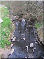
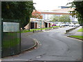
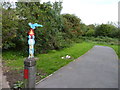
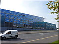

100 photos from this area
Area Information
Key information about the B31 2SQ including its size, population, and administrative classification.
- Area Type
- Postcode
- Area Size
- 1.5 hectares
- Population
- 1604
- Population Density
- 3296 people/km²
House Prices in B31 2SQ
29
Properties
£179,679
Average Sold Price
£44,500
Lowest Price
£260,000
Highest Price
Showing 29 properties
| Address | Type | Beds | Baths | Last Sale Price | Last Sale Date | |
|---|---|---|---|---|---|---|
| 20 Kemshead Avenue, Birmingham, B31 2SQ | Detached | 3 | 1 | £232,500 | Oct 2025 | |
| 30 Kemshead Avenue, Birmingham, B31 2SQ | Semi-detached | 3 | 1 | £260,000 | Nov 2024 | |
| 36 Kemshead Avenue, Birmingham, B31 2SQ | house | 3 | 1 | £225,000 | Aug 2022 | |
| 50 Kemshead Avenue, Birmingham, B31 2SQ | Semi-detached | 3 | 1 | £210,000 | Nov 2021 | |
| 8 Kemshead Avenue, Birmingham, B31 2SQ | Semi-detached | 3 | - | £220,000 | Jul 2019 | |
| 28 Kemshead Avenue, Birmingham, B31 2SQ | Semi-detached | 3 | 1 | £183,000 | Dec 2018 | |
| 48 Kemshead Avenue, Birmingham, B31 2SQ | Semi-detached | 3 | 1 | £227,000 | Sep 2018 | |
| 52 Kemshead Avenue, Birmingham, B31 2SQ | house | - | - | £191,000 | Apr 2017 | |
| 12 Kemshead Avenue, Birmingham, B31 2SQ | Semi-detached | 3 | 1 | £194,000 | Apr 2017 | |
| 40 Kemshead Avenue, Birmingham, B31 2SQ | Semi-detached | 3 | - | £147,000 | Nov 2013 |
Page 1 of 3
Energy Efficiency in B31 2SQ
Amenities
Schools
| Rank | School | Type | Entry gender | Ages |
|---|
Explore more schools in this area
Go to Schools tabDemographics
Household Size
Family (3-5 people)
most common
Accommodation Type
Houses
most common
Tenure
73
majority
Ethnic Group
White
most common
Religion
N/A
most common
Household Composition
N/A
most common
Age
47
median
Adults (30-64 years)
most common
Household Deprivation
N/A
with no deprivation
NS-SEC
30
in Lower managerial occupations
Explore more demographic insights in this area
Go to Demographics tabPlanning
Planning Constraints
- Flood RiskPremium
- Ramsar Wetland SitesPremium
- Area of Outstanding Natural BeautyPremium
- Protected Nature ReservePremium
- Protected WoodlandPremium