Area Overview for B31 2HP
Photos of B31 2HP

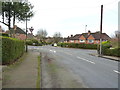
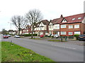
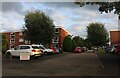
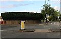
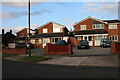
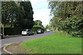
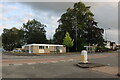
32 photos from this area
Area Information
Key information about the B31 2HP including its size, population, and administrative classification.
- Area Type
- Postcode
- Area Size
- 3432 m²
- Population
- 2093
- Population Density
- 7658 people/km²
House Prices in B31 2HP
12
Properties
£85,908
Average Sold Price
£46,500
Lowest Price
£130,000
Highest Price
Showing 12 properties
| Address | Type | Beds | Baths | Last Sale Price | Last Sale Date | |
|---|---|---|---|---|---|---|
| 20 Middleton Grange, Birmingham, B31 2HP | Terraced | 2 | 1 | £118,000 | Feb 2016 | |
| 14 Middleton Grange, Birmingham, B31 2HP | Terraced | 2 | 2 | £130,000 | Dec 2007 | |
| 22 Middleton Grange, Birmingham, B31 2HP | house | - | - | £86,950 | Sep 2003 | |
| 3 Middleton Grange, Birmingham, B31 2HP | house | 2 | - | £78,000 | Jan 2003 | |
| 18 Middleton Grange, Birmingham, B31 2HP | Terraced | - | - | £56,000 | Apr 2000 | |
| 9 Middleton Grange, Birmingham, B31 2HP | house | - | - | £46,500 | May 1997 | |
| 12 Middleton Grange, Birmingham, B31 2HP | Semi-detached | 2 | 1 | - | - | |
| 10 Middleton Grange, Birmingham, B31 2HP | Bungalow | 2 | 1 | - | - | |
| 5 Middleton Grange, Birmingham, B31 2HP | house | - | - | - | - | |
| 7 Middleton Grange, Birmingham, B31 2HP | Terraced | - | - | - | - |
Page 1 of 2
Energy Efficiency in B31 2HP
Amenities
Schools
| Rank | School | Type | Entry gender | Ages |
|---|
Explore more schools in this area
Go to Schools tabDemographics
Household Size
Family (3-5 people)
most common
Accommodation Type
Houses
most common
Tenure
39
majority
Ethnic Group
White
most common
Religion
N/A
most common
Household Composition
N/A
most common
Age
47
median
Adults (30-64 years)
most common
Household Deprivation
N/A
with no deprivation
NS-SEC
23
in Lower managerial occupations
Explore more demographic insights in this area
Go to Demographics tabPlanning
Planning Constraints
- Flood RiskPremium
- Ramsar Wetland SitesPremium
- Area of Outstanding Natural BeautyPremium
- Protected Nature ReservePremium
- Protected WoodlandPremium