Area Overview for B31 2EF
Photos of B31 2EF


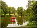

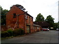
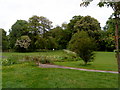

64 photos from this area
Area Information
Key information about the B31 2EF including its size, population, and administrative classification.
- Area Type
- Postcode
- Area Size
- 2.6 hectares
- Population
- 1432
- Population Density
- 2782 people/km²
House Prices in B31 2EF
26
Properties
£335,258
Average Sold Price
£135,000
Lowest Price
£725,000
Highest Price
Showing 26 properties
| Address | Type | Beds | Baths | Last Sale Price | Last Sale Date | |
|---|---|---|---|---|---|---|
| 43 Wynds Point, Birmingham, B31 2EF | Detached | 4 | 2 | £725,000 | Aug 2025 | |
| 10 Wynds Point, Birmingham, B31 2EF | Detached | 4 | 2 | £662,500 | Dec 2023 | |
| 34 Wynds Point, Birmingham, B31 2EF | house | - | - | £605,000 | Mar 2021 | |
| 37 Wynds Point, Birmingham, B31 2EF | Detached | 4 | 1 | £432,500 | Mar 2017 | |
| 26 Wynds Point, Birmingham, B31 2EF | Detached | 4 | 1 | £465,000 | Jan 2017 | |
| 28 Wynds Point, Birmingham, B31 2EF | Detached | 4 | - | £437,500 | Jan 2017 | |
| 42 Wynds Point, Birmingham, B31 2EF | Detached | 4 | - | £375,000 | Apr 2016 | |
| 32 Wynds Point, Birmingham, B31 2EF | Detached | 5 | - | £450,000 | Feb 2015 | |
| 45 Wynds Point, Birmingham, B31 2EF | house | 4 | - | £425,000 | Oct 2010 | |
| 24 Wynds Point, Birmingham, B31 2EF | house | 4 | - | £337,000 | Oct 2010 |
Page 1 of 3
Energy Efficiency in B31 2EF
Amenities
Schools
| Rank | School | Type | Entry gender | Ages |
|---|
Explore more schools in this area
Go to Schools tabDemographics
Household Size
Two person
most common
Accommodation Type
Houses
most common
Tenure
50
majority
Ethnic Group
White
most common
Religion
N/A
most common
Household Composition
N/A
most common
Age
47
median
Adults (30-64 years)
most common
Household Deprivation
N/A
with no deprivation
NS-SEC
38
in Lower managerial occupations
Explore more demographic insights in this area
Go to Demographics tabPlanning
Planning Constraints
- Flood RiskPremium
- Ramsar Wetland SitesPremium
- Area of Outstanding Natural BeautyPremium
- Protected Nature ReservePremium
- Protected WoodlandPremium