Area Overview for B30 3NQ
Photos of B30 3NQ
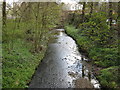

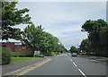
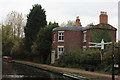
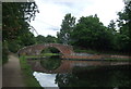
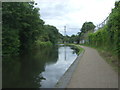

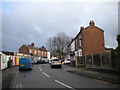
90 photos from this area
Area Information
Key information about the B30 3NQ including its size, population, and administrative classification.
- Area Type
- Postcode
- Area Size
- 1.6 hectares
- Population
- 1560
- Population Density
- 4414 people/km²
House Prices in B30 3NQ
55
Properties
£144,209
Average Sold Price
£49,000
Lowest Price
£232,000
Highest Price
Showing 55 properties
| Address | Type | Beds | Baths | Last Sale Price | Last Sale Date | |
|---|---|---|---|---|---|---|
| 56 Broad Meadow Lane, Birmingham, B30 3NQ | Semi-detached | 3 | 1 | £232,000 | Dec 2024 | |
| 42 Broad Meadow Lane, Birmingham, B30 3NQ | Retail | 3 | 1 | £220,000 | Jun 2022 | |
| 108 Broad Meadow Lane, Birmingham, B30 3NQ | Semi-detached | 3 | 1 | £229,950 | Dec 2021 | |
| 106 Broad Meadow Lane, Birmingham, B30 3NQ | house | 3 | - | £198,000 | May 2021 | |
| 102 Broad Meadow Lane, Birmingham, B30 3NQ | house | 3 | - | £184,500 | Jan 2021 | |
| 96 Broad Meadow Lane, Birmingham, B30 3NQ | Semi-detached | 3 | 1 | £165,000 | Aug 2019 | |
| 86 Broad Meadow Lane, Birmingham, B30 3NQ | Semi-detached | 3 | 1 | £120,000 | Mar 2019 | |
| 60 Broad Meadow Lane, Birmingham, B30 3NQ | house | 3 | 1 | £149,000 | Dec 2017 | |
| 114 Broad Meadow Lane, Birmingham, B30 3NQ | Semi-detached | 3 | 1 | £144,000 | Jul 2017 | |
| 138 Broad Meadow Lane, Birmingham, B30 3NQ | Flat | - | - | £75,000 | Mar 2017 |
Page 1 of 6
Energy Efficiency in B30 3NQ
Amenities
Schools
| Rank | School | Type | Entry gender | Ages |
|---|
Explore more schools in this area
Go to Schools tabDemographics
Household Size
One person
most common
Accommodation Type
Houses
most common
Tenure
57
majority
Ethnic Group
White
most common
Religion
N/A
most common
Household Composition
N/A
most common
Age
47
median
Adults (30-64 years)
most common
Household Deprivation
N/A
with no deprivation
NS-SEC
28
in Lower managerial occupations
Explore more demographic insights in this area
Go to Demographics tabPlanning
Planning Constraints
- Flood RiskPremium
- Ramsar Wetland SitesPremium
- Area of Outstanding Natural BeautyPremium
- Protected Nature ReservePremium
- Protected WoodlandPremium