Area Overview for B30 3LD
Photos of B30 3LD
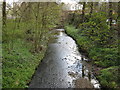
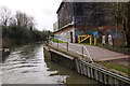
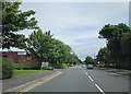
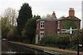
90 photos from this area
Area Information
Key information about the B30 3LD including its size, population, and administrative classification.
- Area Type
- Postcode
- Area Size
- 4.2 hectares
- Population
- 1560
- Population Density
- 4414 people/km²
House Prices in B30 3LD
65
Properties
£124,513
Average Sold Price
£45,000
Lowest Price
£246,000
Highest Price
Showing 65 properties
| Address | Type | Beds | Baths | Last Sale Price | Last Sale Date | |
|---|---|---|---|---|---|---|
| 101 Baldwin Road, Birmingham, B30 3LD | Terraced | 2 | 1 | £184,000 | Feb 2024 | |
| 149 Baldwin Road, Birmingham, B30 3LD | Terraced | 2 | 1 | £246,000 | Aug 2023 | |
| 139 Baldwin Road, Birmingham, B30 3LD | Terraced | 3 | 3 | £233,000 | Feb 2023 | |
| 133 Baldwin Road, Birmingham, B30 3LD | house | - | - | £180,000 | Jan 2023 | |
| 87 Baldwin Road, Birmingham, B30 3LD | Terraced | - | - | £110,000 | Aug 2021 | |
| 103 Baldwin Road, Birmingham, B30 3LD | Terraced | 2 | 1 | £144,950 | Jan 2018 | |
| 129 Baldwin Road, Birmingham, B30 3LD | Terraced | 3 | 1 | £117,000 | Jul 2014 | |
| 111 Baldwin Road, Birmingham, B30 3LD | house | - | - | £100,000 | Oct 2013 | |
| 79 Baldwin Road, Birmingham, B30 3LD | Terraced | 2 | 1 | £91,500 | Aug 2013 | |
| 125 Baldwin Road, Birmingham, B30 3LD | house | - | - | £88,000 | Apr 2013 |
Page 1 of 7
Energy Efficiency in B30 3LD
Amenities
Schools
| Rank | School | Type | Entry gender | Ages |
|---|
Explore more schools in this area
Go to Schools tabDemographics
Household Size
One person
most common
Accommodation Type
Houses
most common
Tenure
57
majority
Ethnic Group
White
most common
Religion
N/A
most common
Household Composition
N/A
most common
Age
47
median
Adults (30-64 years)
most common
Household Deprivation
N/A
with no deprivation
NS-SEC
28
in Lower managerial occupations
Explore more demographic insights in this area
Go to Demographics tabPlanning
Planning Constraints
- Flood RiskPremium
- Ramsar Wetland SitesPremium
- Area of Outstanding Natural BeautyPremium
- Protected Nature ReservePremium
- Protected WoodlandPremium