Area Overview for B30 2SE
Photos of B30 2SE
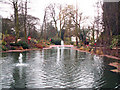
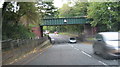
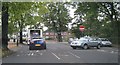
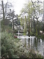
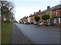
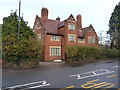
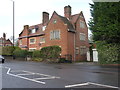
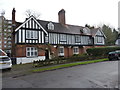
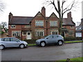

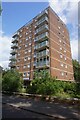
33 photos from this area
Area Information
Key information about the B30 2SE including its size, population, and administrative classification.
- Area Type
- Postcode
- Area Size
- 1.3 hectares
- Population
- 1459
- Population Density
- 4929 people/km²
House Prices in B30 2SE
24
Properties
£168,083
Average Sold Price
£125,000
Lowest Price
£320,000
Highest Price
Showing 24 properties
| Address | Type | Beds | Baths | Last Sale Price | Last Sale Date | |
|---|---|---|---|---|---|---|
| 50 Cartland Road, Bournville, Birmingham, B30 2SE | Terraced | 3 | 1 | £320,000 | Feb 2023 | |
| 90 Cartland Road, Bournville, Birmingham, B30 2SE | Semi-detached | 3 | 1 | £195,000 | Jan 2020 | |
| 48 Cartland Road, Bournville, Birmingham, B30 2SE | Terraced | 3 | 1 | £188,000 | Mar 2018 | |
| 52 Cartland Road, Bournville, Birmingham, B30 2SE | Semi-detached | 3 | 2 | £167,500 | Jun 2015 | |
| 86 Cartland Road, Bournville, Birmingham, B30 2SE | Semi-detached | 3 | 1 | £160,000 | Dec 2014 | |
| 44 Cartland Road, Bournville, Birmingham, B30 2SE | house | 3 | - | £152,500 | Oct 2010 | |
| 70 Cartland Road, Bournville, Birmingham, B30 2SE | Semi-detached | 3 | 2 | £153,000 | Jul 2010 | |
| 68 Cartland Road, Bournville, Birmingham, B30 2SE | house | - | - | £125,000 | Nov 2008 | |
| 72 Cartland Road, Bournville, Birmingham, B30 2SE | Detached | 3 | 1 | £143,000 | Jun 2007 | |
| 56 Cartland Road, Bournville, Birmingham, B30 2SE | house | - | - | £133,000 | Jan 2007 |
Page 1 of 3
Energy Efficiency in B30 2SE
Amenities
Schools
| Rank | School | Type | Entry gender | Ages |
|---|
Explore more schools in this area
Go to Schools tabDemographics
Household Size
Family (3-5 people)
most common
Accommodation Type
Houses
most common
Tenure
82
majority
Ethnic Group
White
most common
Religion
N/A
most common
Household Composition
N/A
most common
Age
47
median
Adults (30-64 years)
most common
Household Deprivation
N/A
with no deprivation
NS-SEC
41
in Lower managerial occupations
Explore more demographic insights in this area
Go to Demographics tabPlanning
Planning Constraints
- Flood RiskPremium
- Ramsar Wetland SitesPremium
- Area of Outstanding Natural BeautyPremium
- Protected Nature ReservePremium
- Protected WoodlandPremium