Area Overview for B30 2NL
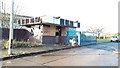
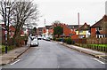
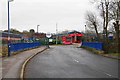
Photos of B30 2NL

Area Information
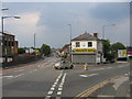
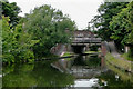
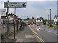
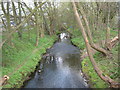
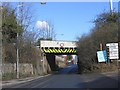
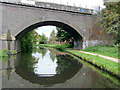
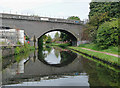
Living in B30 2NL means inhabiting a small, tightly knit residential cluster in south-west Birmingham, where history and modernity intersect. With a population of 1,574, this area is defined by its Victorian terracing, historical pasture lands, and proximity to canals and railways that shaped its industrial past. The median age of 47 suggests a community of established residents, many of whom are in their prime working years. The area’s character is rooted in its heritage, from the 1911 Stirchley Baths to the 1931 Stirchley Pavilion cinema, offering a blend of quiet suburban life and accessible urban amenities. Residents benefit from proximity to five railway stations, including Bournville and Selly Oak, and retail hubs like Tesco Birmingham. While the area’s size is modest, its strategic location near Edgbaston Village and Centenary Square ensures a balance between tranquillity and connectivity. For those seeking a place with historical depth and practical modern conveniences, B30 2NL presents a compelling case.
- Area Type
- Postcode
- Area Size
- Not available
- Population
- 1574
- Population Density
- 4669 people/km²
The property market in B30 2NL is characterised by a high rate of home ownership (65%) and a predominance of houses over flats or other accommodation types. This suggests a community of long-term residents with a preference for traditional, owner-occupied homes. The small residential cluster means the housing stock is likely limited in scale, with properties concentrated in Victorian terraces and post-war developments like the Pineapple Farm council estate. For buyers, this implies a market where properties are more likely to be family homes rather than investment opportunities. The lack of high-density housing or rental properties indicates a low turnover of properties, which could mean stable values but fewer options for those seeking newer builds or larger spaces. Proximity to rail links and amenities like Stirchley Baths may enhance desirability, though the area’s compact size means buyers must consider nearby suburbs for broader choices.
House Prices in B30 2NL
No properties found in this postcode.
Energy Efficiency in B30 2NL
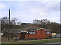
Daily life in B30 2NL is enriched by a mix of historical landmarks and modern amenities. Residents can shop at Aldi on Pershore Road, Farmfoods Stirchley, and Tesco Birmingham, ensuring access to essentials. The area’s proximity to Edgbaston Village and Centenary Square provides opportunities for dining, culture, and leisure. Historic sites like Stirchley Baths, opened in 1911, and the Stirchley Pavilion cinema, dating to 1931, offer a glimpse into the suburb’s heritage. The St Mary Magdalene Church and nearby Selly Manor add to the area’s architectural character. The Stirchley Neighbourhood Forum hosts monthly meetings, fostering community engagement. While the area is small, its strategic location near rail and metro links means residents can easily access Birmingham’s broader offerings, from parks to theatres, without sacrificing the quiet, suburban feel that defines B30 2NL.
Amenities
Schools
| Rank | School | Type | Entry gender | Ages |
|---|
Explore more schools in this area
Go to Schools tabDemographics
The community in B30 2NL is predominantly composed of adults aged 30–64, with a median age of 47. This suggests a stable, mature population, likely with long-term ties to the area. Home ownership is high at 65%, indicating a strong presence of long-term residents rather than transient renters. The accommodation type is primarily houses, reflecting a residential cluster with established properties rather than high-density housing. The predominant ethnic group is White, though specific data on diversity or deprivation is not provided. The age profile and ownership rates imply a community focused on family living and local continuity. With no data on income distribution or deprivation levels, it is reasonable to infer that the area supports a middle-income demographic with access to essential services. The absence of younger or older age groups may suggest a lack of recent development or student housing, shaping a distinctly settled neighbourhood.
Household Size
Accommodation Type
Tenure
Ethnic Group
Religion
Household Composition
Age
Household Deprivation
NS-SEC
Explore more demographic insights in this area
Go to Demographics tabPlanning
Planning Constraints
- Flood RiskPremium
- Ramsar Wetland SitesPremium
- Area of Outstanding Natural BeautyPremium
- Protected Nature ReservePremium
- Protected WoodlandPremium
- Crime RiskPremium