Area Overview for B30 2LY
Photos of B30 2LY


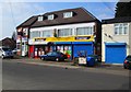
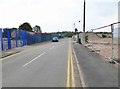
100 photos from this area
Area Information
Key information about the B30 2LY including its size, population, and administrative classification.
- Area Type
- Postcode
- Area Size
- 1.3 hectares
- Population
- 1712
- Population Density
- 4265 people/km²
House Prices in B30 2LY
44
Properties
£123,753
Average Sold Price
£27,000
Lowest Price
£307,000
Highest Price
Showing 44 properties
| Address | Type | Beds | Baths | Last Sale Price | Last Sale Date | |
|---|---|---|---|---|---|---|
| 39 Hawkes Close, Birmingham, B30 2LY | Flat | - | - | £85,000 | Dec 2023 | |
| 1 Hawkes Close, Birmingham, B30 2LY | Semi-detached | 2 | 1 | £249,000 | Oct 2023 | |
| 11 Hawkes Close, Birmingham, B30 2LY | Semi-detached | 2 | 1 | £250,000 | Sep 2023 | |
| 18 Hawkes Close, Birmingham, B30 2LY | Maisonette | 1 | 1 | £148,500 | Jul 2023 | |
| 30 Hawkes Close, Birmingham, B30 2LY | Semi-detached | 2 | 1 | £240,000 | Apr 2023 | |
| 2 Hawkes Close, Birmingham, B30 2LY | Retail | 3 | 1 | £307,000 | Oct 2022 | |
| 23 Hawkes Close, Birmingham, B30 2LY | Semi-detached | 2 | 1 | £280,000 | Aug 2022 | |
| 7 Hawkes Close, Birmingham, B30 2LY | Flat | - | - | £110,000 | Aug 2021 | |
| 6 Hawkes Close, Birmingham, B30 2LY | house | 2 | - | £201,000 | Mar 2021 | |
| 9 Hawkes Close, Birmingham, B30 2LY | Maisonette | 1 | 1 | £125,000 | Jan 2019 |
Page 1 of 5
Energy Efficiency in B30 2LY
Amenities
Schools
| Rank | School | Type | Entry gender | Ages |
|---|
Explore more schools in this area
Go to Schools tabDemographics
Household Size
One person
most common
Accommodation Type
Houses
most common
Tenure
49
majority
Ethnic Group
White
most common
Religion
N/A
most common
Household Composition
N/A
most common
Age
47
median
Adults (30-64 years)
most common
Household Deprivation
N/A
with no deprivation
NS-SEC
27
in Lower managerial occupations
Explore more demographic insights in this area
Go to Demographics tabPlanning
Planning Constraints
- Flood RiskPremium
- Area of Outstanding Natural BeautyPremium
- Protected Nature ReservePremium
- Protected WoodlandPremium