Area Overview for B30 2LD
Photos of B30 2LD


Area Information
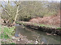
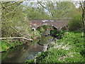
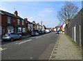
Living in B30 2LD means being part of a small, defined residential cluster in south-west Birmingham. With a population of 1,767, the area is compact yet historically rich, centred around Stirchley’s Victorian terracing and industrial heritage. The postcode sits within Stirchley Ward, a district that once straddled Worcestershire before administrative changes in 1911. Daily life here is shaped by its proximity to Bournville and Selly Oak, with a mix of older homes and community spaces. The median age of 47 suggests a settled population, many of whom are in their prime working years. While the area lacks large-scale commercial hubs, its quiet streets and historical sites—like Stirchley Baths and the Stirchley Neighbourhood Forum—offer a distinct character. Residents benefit from nearby rail links and a strong sense of local identity, though the area’s small size means amenities are concentrated within walking or cycling distance. For those seeking a balance between tradition and practicality, B30 2LD provides a focused, community-oriented environment.
- Area Type
- Postcode
- Area Size
- Not available
- Population
- 1767
- Population Density
- 4629 people/km²
The property market in B30 2LD is characterised by a 53% home ownership rate, with houses being the primary accommodation type. This suggests a mix of owner-occupied properties and rental stock, though the small area’s limited size means the housing stock is not extensive. The prevalence of houses rather than flats or apartments indicates a focus on traditional, often older homes, many of which may have been built in the Victorian era. For buyers, this means a market that prioritises private ownership over high-density living, with potential for character properties. However, the area’s compact nature means opportunities for expansion or development are likely constrained. Prospective buyers should consider the localised nature of the market, where properties are closely clustered and competition may be limited to a small pool of homes.
House Prices in B30 2LD
No properties found in this postcode.
Energy Efficiency in B30 2LD
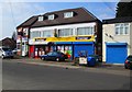
The lifestyle in B30 2LD is shaped by its proximity to retail, rail, and metro services. Local shops include Aldi, Morrisons, and Farmfoods, providing essential grocery and household goods within walking distance. The area’s rail stations—Bournville, Kings Norton, and Selly Oak—offer easy access to Birmingham’s wider network, while metro stops at Edgbaston Village and Grand Central New Street connect to the city’s commercial and cultural hubs. Though the area lacks large parks or leisure facilities, its compact nature encourages walking and cycling. The historical sites, such as Stirchley Baths and Selly Manor, add a layer of heritage to daily life. The combination of practical amenities and local landmarks creates a balanced environment, where convenience meets a sense of place.
Amenities
Schools
The nearest schools to B30 2LD include Stirchley Primary School, listed twice in the data, both as primary institutions. While no Ofsted ratings are provided, the presence of two primary schools within the area suggests a focus on early education for local families. The lack of secondary schools or specialist provisions means parents may need to look beyond the immediate postcode for secondary education. The dual listing of Stirchley Primary School may indicate a larger school complex or a shared campus, though this is not confirmed. For families prioritising primary schooling, the availability of two options is a practical advantage, though the absence of secondary schools could influence broader educational planning.
| Rank | School | Type | Entry gender | Ages |
|---|---|---|---|---|
| 1 | Stirchley Primary School | primary | N/A | N/A |
| 2 | Stirchley Primary School | primary | N/A | N/A |
Explore more schools in this area
Go to Schools tabDemographics
The community in B30 2LD is predominantly composed of adults aged 30–64, reflecting a median age of 47. This suggests a population largely in their working years, with 53% owning their homes and the rest likely renting. The accommodation type is primarily houses, which is unusual for urban areas, indicating a mix of older, standalone properties. The predominant ethnic group is White, though no further breakdown of diversity is provided. The relatively high home ownership rate (53%) suggests a stable, long-term resident base, though the area’s small size means it is not a major demographic hub. The absence of specific deprivation data means the quality of life cannot be fully contextualised, but the age profile and housing stock imply a mature, settled community.
Household Size
Accommodation Type
Tenure
Ethnic Group
Religion
Household Composition
Age
Household Deprivation
NS-SEC
Explore more demographic insights in this area
Go to Demographics tabPlanning
Planning Constraints
- Flood RiskPremium
- Ramsar Wetland SitesPremium
- Area of Outstanding Natural BeautyPremium
- Protected Nature ReservePremium
- Protected WoodlandPremium
- Crime RiskPremium