Area Overview for B30 2HU
Photos of B30 2HU
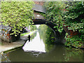

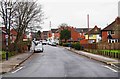
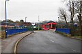
100 photos from this area
Area Information
Key information about the B30 2HU including its size, population, and administrative classification.
- Area Type
- Postcode
- Area Size
- 1.6 hectares
- Population
- 1604
- Population Density
- 6827 people/km²
House Prices in B30 2HU
65
Properties
£158,380
Average Sold Price
£41,000
Lowest Price
£310,000
Highest Price
Showing 65 properties
| Address | Type | Beds | Baths | Last Sale Price | Last Sale Date | |
|---|---|---|---|---|---|---|
| 61 Heathcote Road, Birmingham, B30 2HU | Terraced | 3 | 1 | £276,250 | Sep 2025 | |
| 22 Heathcote Road, Birmingham, B30 2HU | Terraced | 3 | 1 | £300,075 | Dec 2024 | |
| 47 Heathcote Road, Birmingham, B30 2HU | Semi-detached | 3 | 1 | £296,250 | Nov 2024 | |
| 50 Heathcote Road, Birmingham, B30 2HU | Terraced | 2 | 1 | £251,000 | Jun 2024 | |
| 60 Heathcote Road, Birmingham, B30 2HU | house | - | - | £167,500 | May 2024 | |
| 58 Heathcote Road, Birmingham, B30 2HU | Terraced | 2 | 1 | £233,150 | Jun 2023 | |
| 71 Heathcote Road, Birmingham, B30 2HU | Retail | 2 | 1 | £205,000 | Aug 2022 | |
| 69 Heathcote Road, Birmingham, B30 2HU | Terraced | 3 | 1 | £205,000 | Jun 2022 | |
| 55 Heathcote Road, Birmingham, B30 2HU | house | 3 | - | £218,000 | Dec 2021 | |
| 34 Heathcote Road, Birmingham, B30 2HU | house | - | - | £220,000 | Nov 2021 |
Page 1 of 7
Energy Efficiency in B30 2HU
Amenities
Schools
| Rank | School | Type | Entry gender | Ages |
|---|
Explore more schools in this area
Go to Schools tabDemographics
Household Size
Two person
most common
Accommodation Type
Houses
most common
Tenure
55
majority
Ethnic Group
White
most common
Religion
N/A
most common
Household Composition
N/A
most common
Age
47
median
Adults (30-64 years)
most common
Household Deprivation
N/A
with no deprivation
NS-SEC
32
in Lower managerial occupations
Explore more demographic insights in this area
Go to Demographics tabPlanning
Planning Constraints
- Flood RiskPremium
- Ramsar Wetland SitesPremium
- Area of Outstanding Natural BeautyPremium
- Protected Nature ReservePremium
- Protected WoodlandPremium