Area Overview for B30 2DY
Photos of B30 2DY
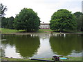

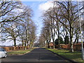
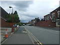
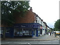
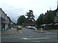
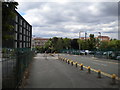
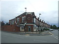
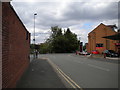
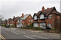
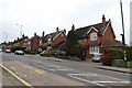

47 photos from this area
Area Information
Key information about the B30 2DY including its size, population, and administrative classification.
- Area Type
- Postcode
- Area Size
- 7458 m²
- Population
- 1410
- Population Density
- 3757 people/km²
House Prices in B30 2DY
33
Properties
£241,508
Average Sold Price
£49,950
Lowest Price
£440,000
Highest Price
Showing 33 properties
| Address | Type | Beds | Baths | Last Sale Price | Last Sale Date | |
|---|---|---|---|---|---|---|
| 16 Beaumont Road, Birmingham, B30 2DY | Terraced | 3 | 1 | £372,000 | May 2025 | |
| 24 Beaumont Road, Birmingham, B30 2DY | Terraced | 5 | 2 | £440,000 | Aug 2024 | |
| 40 Beaumont Road, Birmingham, B30 2DY | house | - | - | £68,000 | Jul 2024 | |
| 54 Beaumont Road, Birmingham, B30 2DY | Terraced | 3 | 1 | £375,000 | Apr 2024 | |
| 52 Beaumont Road, Birmingham, B30 2DY | Terraced | 3 | 1 | £366,000 | Feb 2024 | |
| 38 Beaumont Road, Birmingham, B30 2DY | house | - | - | £370,000 | Nov 2023 | |
| 34 Beaumont Road, Birmingham, B30 2DY | Terraced | 3 | 1 | £385,500 | Nov 2022 | |
| 36 Beaumont Road, Birmingham, B30 2DY | Terraced | 3 | 1 | £295,000 | Jan 2021 | |
| 30 Beaumont Road, Birmingham, B30 2DY | house | - | - | £340,000 | Nov 2020 | |
| 58 Beaumont Road, Birmingham, B30 2DY | Terraced | 3 | - | £305,000 | Sep 2018 |
Page 1 of 4
Energy Efficiency in B30 2DY
Amenities
Schools
| Rank | School | Type | Entry gender | Ages |
|---|
Explore more schools in this area
Go to Schools tabDemographics
Household Size
Family (3-5 people)
most common
Accommodation Type
Houses
most common
Tenure
57
majority
Ethnic Group
White
most common
Religion
N/A
most common
Household Composition
N/A
most common
Age
47
median
Adults (30-64 years)
most common
Household Deprivation
N/A
with no deprivation
NS-SEC
47
in Lower managerial occupations
Explore more demographic insights in this area
Go to Demographics tabPlanning
Planning Constraints
- Flood RiskPremium
- Ramsar Wetland SitesPremium
- Area of Outstanding Natural BeautyPremium
- Protected Nature ReservePremium
- Protected WoodlandPremium