Area Overview for B30 1HA
Photos of B30 1HA
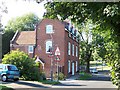
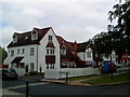
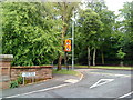


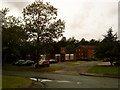

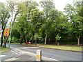
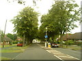


42 photos from this area
Area Information
Key information about the B30 1HA including its size, population, and administrative classification.
- Area Type
- Postcode
- Area Size
- 2.1 hectares
- Population
- 1551
- Population Density
- 4748 people/km²
House Prices in B30 1HA
35
Properties
£320,365
Average Sold Price
£60,000
Lowest Price
£587,100
Highest Price
Showing 35 properties
| Address | Type | Beds | Baths | Last Sale Price | Last Sale Date | |
|---|---|---|---|---|---|---|
| 53 Woodlands Park Road, Birmingham, B30 1HA | Semi-detached | 4 | 1 | £529,500 | Mar 2025 | |
| 73 Woodlands Park Road, Birmingham, B30 1HA | Detached | 3 | 1 | £450,000 | Sep 2023 | |
| 61 Woodlands Park Road, Birmingham, B30 1HA | house | - | - | £587,100 | Aug 2021 | |
| 71 Woodlands Park Road, Birmingham, B30 1HA | Semi-detached | 3 | 1 | £400,000 | Dec 2020 | |
| 51 Woodlands Park Road, Birmingham, B30 1HA | Semi-detached | 4 | 2 | £520,000 | Jul 2020 | |
| 60 Woodlands Park Road, Birmingham, B30 1HA | Semi-detached | 3 | 2 | £385,000 | Aug 2019 | |
| 67 Woodlands Park Road, Birmingham, B30 1HA | house | 3 | - | £425,000 | Jul 2019 | |
| 75 Woodlands Park Road, Birmingham, B30 1HA | Detached | 2 | 1 | £343,386 | Sep 2018 | |
| 59 Woodlands Park Road, Birmingham, B30 1HA | Semi-detached | 3 | 1 | £380,000 | Aug 2017 | |
| 69 Woodlands Park Road, Birmingham, B30 1HA | Semi-detached | 4 | 2 | £330,000 | Sep 2014 |
Page 1 of 4
Energy Efficiency in B30 1HA
Amenities
Schools
| Rank | School | Type | Entry gender | Ages |
|---|
Explore more schools in this area
Go to Schools tabDemographics
Household Size
One person
most common
Accommodation Type
Houses
most common
Tenure
29
majority
Ethnic Group
White
most common
Religion
N/A
most common
Household Composition
N/A
most common
Age
47
median
Adults (30-64 years)
most common
Household Deprivation
N/A
with no deprivation
NS-SEC
27
in Lower managerial occupations
Explore more demographic insights in this area
Go to Demographics tabPlanning
Planning Constraints
- Flood RiskPremium
- Ramsar Wetland SitesPremium
- Area of Outstanding Natural BeautyPremium
- Protected Nature ReservePremium
- Protected WoodlandPremium