Area Overview for B30 1EQ
Photos of B30 1EQ
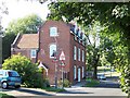
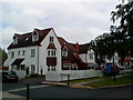
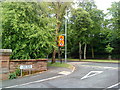
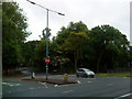
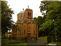
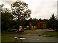

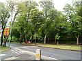
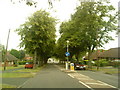
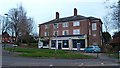

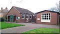
42 photos from this area
Area Information
Key information about the B30 1EQ including its size, population, and administrative classification.
- Area Type
- Postcode
- Area Size
- 1.2 hectares
- Population
- 1732
- Population Density
- 4640 people/km²
House Prices in B30 1EQ
18
Properties
£323,718
Average Sold Price
£103,500
Lowest Price
£518,000
Highest Price
Showing 18 properties
| Address | Type | Beds | Baths | Last Sale Price | Last Sale Date | |
|---|---|---|---|---|---|---|
| 33 Hawthorne Road, Bournville, Birmingham, B30 1EQ | house | - | - | £518,000 | Oct 2020 | |
| 53 Hawthorne Road, Bournville, Birmingham, B30 1EQ | Semi-detached | 3 | - | £485,000 | Aug 2018 | |
| 31 Hawthorne Road, Bournville, Birmingham, B30 1EQ | Semi-detached | 4 | 2 | £505,000 | Oct 2016 | |
| 45 Hawthorne Road, Bournville, Birmingham, B30 1EQ | Semi-detached | 4 | 1 | £376,000 | Jun 2015 | |
| 41 Hawthorne Road, Bournville, Birmingham, B30 1EQ | house | - | - | £268,000 | Dec 2009 | |
| 29 Hawthorne Road, Bournville, Birmingham, B30 1EQ | house | - | - | £260,000 | Oct 2009 | |
| 39 Hawthorne Road, Bournville, Birmingham, B30 1EQ | house | - | - | £261,000 | Oct 2009 | |
| 43 Hawthorne Road, Bournville, Birmingham, B30 1EQ | Terraced | - | - | £295,000 | Dec 2004 | |
| 27 Hawthorne Road, Bournville, Birmingham, B30 1EQ | Semi-detached | - | - | £165,675 | Nov 2000 | |
| 23 Hawthorne Road, Bournville, Birmingham, B30 1EQ | house | - | - | £103,500 | Jun 1995 |
Page 1 of 2
Energy Efficiency in B30 1EQ
Amenities
Schools
| Rank | School | Type | Entry gender | Ages |
|---|
Explore more schools in this area
Go to Schools tabDemographics
Household Size
One person
most common
Accommodation Type
Houses
most common
Tenure
59
majority
Ethnic Group
White
most common
Religion
N/A
most common
Household Composition
N/A
most common
Age
47
median
Adults (30-64 years)
most common
Household Deprivation
N/A
with no deprivation
NS-SEC
40
in Lower managerial occupations
Explore more demographic insights in this area
Go to Demographics tabPlanning
Planning Constraints
- Flood RiskPremium
- Ramsar Wetland SitesPremium
- Area of Outstanding Natural BeautyPremium
- Protected Nature ReservePremium
- Protected WoodlandPremium