Area Overview for B29 9EN
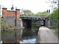
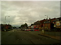
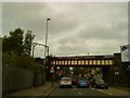
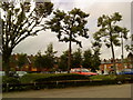
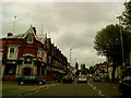
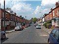
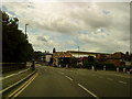
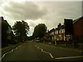
Photos of B29 9EN


Area Information
Living in B29 9EN means inhabiting a small, residential postcode in southwest Birmingham, where history and modernity intersect. The area, part of the Bournville and Cotteridge Ward, retains its 19th-century garden village character, originally designed by the Cadbury family as a model workers’ settlement. With a population of 4,344, it is a compact community defined by low-density housing, tree-lined streets, and conservation status. The area’s heritage is evident in its historic buildings, including relocated 14th-century timber-framed structures and the still-operational Cadbury chocolate factory. Daily life here balances suburban tranquillity with proximity to urban amenities. Residents benefit from nearby rail links, retail hubs, and green spaces, while the area’s Quaker roots mean alcohol sales are restricted within the historic estate. B29 9EN is a place where heritage preservation meets practical living, offering a distinct alternative to denser urban environments. Its small size means it is ideal for those seeking a focused, community-oriented lifestyle without sacrificing access to Birmingham’s broader infrastructure.
- Area Type
- Postcode
- Area Size
- Not available
- Population
- 4344
- Population Density
- 6555 people/km²
The property market in B29 9EN is characterised by a 35% home ownership rate, suggesting that the majority of residents rent rather than own their homes. The area’s accommodation type is primarily houses, aligning with its garden village heritage of low-density, spacious properties with private gardens. This mix of housing stock caters to families and individuals seeking larger living spaces, though the small size of the postcode means the market is limited in scope. For buyers, the area’s conservation status and historical significance may influence property values, with potential restrictions on modifications due to the Bournville Village Trust’s oversight. The proximity to Birmingham’s urban core, combined with the area’s unique character, could make it appealing to those prioritising heritage and green space over high-density living. However, the limited number of properties available may mean competition is fierce for those seeking to purchase.
House Prices in B29 9EN
No properties found in this postcode.
Energy Efficiency in B29 9EN
Life in B29 9EN is enriched by a range of nearby amenities within practical reach. Retail options include Iceland, Sainsburys, and Aldi, providing everyday shopping convenience. Metro stops such as Edgbaston Village and Centenary Square offer access to Birmingham’s cultural and commercial hubs. The area’s green spaces, including Cotteridge Park and Bournville Park, provide opportunities for recreation and relaxation, with historical significance adding to their appeal. The presence of the Cadbury chocolate factory and relocated 14th-century buildings offers a unique blend of industrial heritage and leisure. For residents, the mix of retail, transport, and open spaces supports a balanced lifestyle, combining suburban comfort with urban accessibility. The area’s conservation status ensures these amenities remain preserved, contributing to a sense of continuity and community identity.
Amenities
Schools
The only school explicitly listed near B29 9EN is Cherry Oak School, which is designated as a special school. While no Ofsted rating is provided, the presence of a special school suggests the area may cater to families with children requiring tailored educational support. The absence of mainstream primary or secondary schools in the immediate vicinity means residents may need to look beyond the postcode for broader schooling options. This could be a consideration for families prioritising a range of educational institutions. However, the area’s proximity to Birmingham’s larger urban centres, including Edgbaston and Centenary Square, may provide access to additional schools within a short commute. The mix of school types reflects the community’s diversity and the specific needs of its residents.
| Rank | School | Type | Entry gender | Ages |
|---|
Explore more schools in this area
Go to Schools tabDemographics
The population of B29 9EN is overwhelmingly young, with a median age of 22 and the majority (15–29 years) being young adults. This demographic profile suggests a community skewed toward students, early-career professionals, or families with young children. Home ownership here is relatively low at 35%, indicating a higher proportion of renters compared to owner-occupied properties. The predominant accommodation type is houses, reflecting the area’s suburban layout and garden village design. Ethnically, the population is predominantly White, though no specific data on other groups is provided. The high proportion of young adults may influence local services and amenities, with demand for housing and employment opportunities aligning with this age group’s needs. The lower home ownership rate could indicate a transient population or a focus on rental properties, which may affect long-term stability for buyers.
Household Size
Accommodation Type
Tenure
Ethnic Group
Religion
Household Composition
Age
Household Deprivation
NS-SEC
Explore more demographic insights in this area
Go to Demographics tabPlanning
Planning Constraints
- Flood RiskPremium
- Ramsar Wetland SitesPremium
- Area of Outstanding Natural BeautyPremium
- Protected Nature ReservePremium
- Protected WoodlandPremium