Area Overview for B29 7SL
Photos of B29 7SL
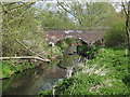
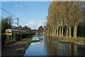
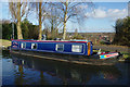
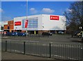
100 photos from this area
Area Information
Key information about the B29 7SL including its size, population, and administrative classification.
- Area Type
- Postcode
- Area Size
- 1.3 hectares
- Population
- 1712
- Population Density
- 4265 people/km²
House Prices in B29 7SL
49
Properties
£177,252
Average Sold Price
£32,500
Lowest Price
£365,000
Highest Price
Showing 49 properties
| Address | Type | Beds | Baths | Last Sale Price | Last Sale Date | |
|---|---|---|---|---|---|---|
| 106 Gristhorpe Road, Birmingham, B29 7SL | Detached | 3 | 1 | £267,500 | Nov 2025 | |
| 162 Gristhorpe Road, Birmingham, B29 7SL | Semi-detached | 2 | 1 | £296,000 | Jul 2025 | |
| 104 Gristhorpe Road, Birmingham, B29 7SL | Detached | 3 | 2 | £292,000 | Jun 2025 | |
| 172 Gristhorpe Road, Birmingham, B29 7SL | Semi-detached | 2 | 1 | £295,000 | Mar 2025 | |
| 88 Gristhorpe Road, Birmingham, B29 7SL | Semi-detached | 3 | 1 | £32,500 | Sep 2024 | |
| 102 Gristhorpe Road, Birmingham, B29 7SL | Semi-detached | 3 | 1 | £265,000 | Feb 2024 | |
| 144 Gristhorpe Road, Birmingham, B29 7SL | Semi-detached | 2 | 1 | £272,000 | Oct 2023 | |
| 180 Gristhorpe Road, Birmingham, B29 7SL | Semi-detached | 2 | 1 | £261,000 | Oct 2022 | |
| 114 Gristhorpe Road, Birmingham, B29 7SL | Semi-detached | 2 | 1 | £280,000 | Jun 2022 | |
| 152 Gristhorpe Road, Birmingham, B29 7SL | house | - | - | £230,000 | Jul 2021 |
Page 1 of 5
Energy Efficiency in B29 7SL
Amenities
Schools
| Rank | School | Type | Entry gender | Ages |
|---|
Explore more schools in this area
Go to Schools tabDemographics
Household Size
One person
most common
Accommodation Type
Houses
most common
Tenure
49
majority
Ethnic Group
White
most common
Religion
N/A
most common
Household Composition
N/A
most common
Age
47
median
Adults (30-64 years)
most common
Household Deprivation
N/A
with no deprivation
NS-SEC
27
in Lower managerial occupations
Explore more demographic insights in this area
Go to Demographics tabPlanning
Planning Constraints
- Flood RiskPremium
- Ramsar Wetland SitesPremium
- Area of Outstanding Natural BeautyPremium
- Protected Nature ReservePremium
- Protected WoodlandPremium