Area Overview for B29 7RL
Photos of B29 7RL
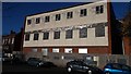
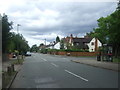
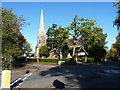
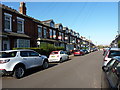
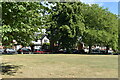
45 photos from this area
Area Information
Key information about the B29 7RL including its size, population, and administrative classification.
- Area Type
- Postcode
- Area Size
- 1.1 hectares
- Population
- 1546
- Population Density
- 7118 people/km²
House Prices in B29 7RL
59
Properties
£136,248
Average Sold Price
£42,000
Lowest Price
£270,000
Highest Price
Showing 59 properties
| Address | Type | Beds | Baths | Last Sale Price | Last Sale Date | |
|---|---|---|---|---|---|---|
| 85 Milner Road, Birmingham, B29 7RL | Terraced | 2 | 1 | £246,000 | Aug 2025 | |
| 43 Milner Road, Birmingham, B29 7RL | Terraced | 2 | 1 | £242,450 | Dec 2024 | |
| 81 Milner Road, Birmingham, B29 7RL | Terraced | 2 | 1 | £245,000 | Nov 2024 | |
| 1 Milner Road, Birmingham, B29 7RL | Terraced | 3 | 1 | £270,000 | Aug 2024 | |
| 59 Milner Road, Birmingham, B29 7RL | Terraced | 2 | 1 | £225,000 | May 2023 | |
| 87 Milner Road, Birmingham, B29 7RL | Terraced | 4 | 2 | £220,000 | Jun 2021 | |
| 75 Milner Road, Birmingham, B29 7RL | house | - | - | £173,000 | Sep 2020 | |
| 33 Milner Road, Birmingham, B29 7RL | Terraced | 3 | 1 | £190,000 | Mar 2020 | |
| 61 Milner Road, Birmingham, B29 7RL | house | 2 | 1 | £147,500 | Dec 2019 | |
| 9A Milner Road, Birmingham, B29 7RL | Terraced | 3 | 1 | £160,000 | Oct 2018 |
Page 1 of 6
Energy Efficiency in B29 7RL
Amenities
Schools
| Rank | School | Type | Entry gender | Ages |
|---|
Explore more schools in this area
Go to Schools tabDemographics
Household Size
Family (3-5 people)
most common
Accommodation Type
Houses
most common
Tenure
58
majority
Ethnic Group
White
most common
Religion
N/A
most common
Household Composition
N/A
most common
Age
47
median
Adults (30-64 years)
most common
Household Deprivation
N/A
with no deprivation
NS-SEC
31
in Lower managerial occupations
Explore more demographic insights in this area
Go to Demographics tabPlanning
Planning Constraints
- Flood RiskPremium
- Ramsar Wetland SitesPremium
- Area of Outstanding Natural BeautyPremium
- Protected Nature ReservePremium
- Protected WoodlandPremium