Area Overview for B29 7LS
Photos of B29 7LS


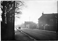


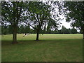


45 photos from this area
Area Information
Key information about the B29 7LS including its size, population, and administrative classification.
- Area Type
- Postcode
- Area Size
- 6963 m²
- Population
- 1346
- Population Density
- 2814 people/km²
House Prices in B29 7LS
48
Properties
£143,188
Average Sold Price
£39,000
Lowest Price
£250,000
Highest Price
Showing 48 properties
| Address | Type | Beds | Baths | Last Sale Price | Last Sale Date | |
|---|---|---|---|---|---|---|
| 852 Pershore Road, Selly Oak, Birmingham, B29 7LS | Terraced | 3 | 1 | £190,000 | Mar 2025 | |
| 842 Pershore Road, Selly Oak, Birmingham, B29 7LS | Terraced | 3 | - | £161,000 | Jan 2024 | |
| 844 Pershore Road, Selly Oak, Birmingham, B29 7LS | Terraced | 3 | 1 | £167,000 | Jan 2024 | |
| 806 Pershore Road, Selly Oak, Birmingham, B29 7LS | Flat | - | - | £170,000 | Oct 2023 | |
| 836 Pershore Road, Selly Oak, Birmingham, B29 7LS | Terraced | 3 | 2 | £170,000 | Feb 2022 | |
| 874A Pershore Road, Selly Oak, Birmingham, B29 7LS | Flat | 3 | 2 | £181,000 | Sep 2021 | |
| 876 Pershore Road, Selly Oak, Birmingham, B29 7LS | house | - | - | £225,000 | Jun 2021 | |
| 848 Pershore Road, Selly Oak, Birmingham, B29 7LS | Terraced | 3 | 1 | £165,000 | Mar 2021 | |
| 802 Pershore Road, Selly Oak, Birmingham, B29 7LS | Terraced | 3 | 3 | £135,000 | Sep 2020 | |
| 854 Pershore Road, Selly Oak, Birmingham, B29 7LS | Terraced | 3 | 1 | £200,000 | Aug 2020 |
Page 1 of 5
Energy Efficiency in B29 7LS
Amenities
Schools
| Rank | School | Type | Entry gender | Ages |
|---|
Explore more schools in this area
Go to Schools tabDemographics
Household Size
Two person
most common
Accommodation Type
Houses
most common
Tenure
64
majority
Ethnic Group
White
most common
Religion
N/A
most common
Household Composition
N/A
most common
Age
47
median
Adults (30-64 years)
most common
Household Deprivation
N/A
with no deprivation
NS-SEC
45
in Lower managerial occupations
Explore more demographic insights in this area
Go to Demographics tabPlanning
Planning Constraints
- Flood RiskPremium
- Ramsar Wetland SitesPremium
- Area of Outstanding Natural BeautyPremium
- Protected Nature ReservePremium
- Protected WoodlandPremium