Area Overview for B29 6SL
Photos of B29 6SL


Area Information
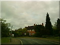
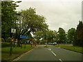
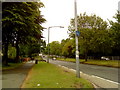
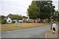
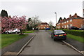
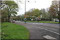
Living in B29 6SL means being part of a small, tightly knit residential cluster in the southwest of Birmingham, England. The area, known as Bournville and Cotteridge, blends historic charm with modern convenience. With a population of 1,544, it retains a quiet, suburban character shaped by its origins as a 19th-century model village founded by the Quaker Cadbury family. The area’s planned garden village design, tree-lined streets, and conservation status create a distinct atmosphere. Residents benefit from proximity to the historic Cadbury chocolate factory, now a landmark, and access to nearby schools, rail networks, and green spaces. Daily life here is defined by low-density housing, spacious gardens, and a sense of community rooted in the area’s heritage. The absence of commercial sprawl ensures a tranquil environment, while nearby amenities like Sainsburys and rail stations provide practical connectivity. B29 6SL is ideal for those seeking a balance between historical significance, residential comfort, and ease of access to Birmingham’s broader infrastructure.
- Area Type
- Postcode
- Area Size
- Not available
- Population
- 1544
- Population Density
- 2249 people/km²
B29 6SL is predominantly an owner-occupied area, with 55% of homes owned by residents rather than rented. The housing stock consists mainly of houses, reflecting the area’s suburban, low-density character. This contrasts with higher-density urban areas and suggests a focus on family homes with gardens, aligned with the historic garden village design. The small size of the postcode area means the housing market is tightly concentrated, with limited new developments. For buyers, this creates a niche market where properties are likely to retain value due to the area’s conservation status and heritage. However, the limited supply may also drive competition among buyers. The predominance of owner-occupied homes indicates a stable, long-term resident base, which can be a positive sign for property investment.
House Prices in B29 6SL
No properties found in this postcode.
Energy Efficiency in B29 6SL
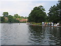
Daily life in B29 6SL is enriched by a mix of retail, transport, and green spaces. The area’s retail offerings include Morrisons Daily, Iceland Selly, and Sainsburys Selly, providing essentials within easy reach. Rail stations like Selly Oak and Bournville connect residents to Birmingham’s wider network, while metro stops at Edgbaston Village and Centenary Square enhance mobility. Nearby, Bournville Park and Cotteridge Park offer recreational spaces, with the latter preserving historic farmland and ancient trees. The area’s heritage also includes the Cadbury chocolate factory and relocated 14th-century buildings, adding cultural value. This blend of practical amenities and natural spaces supports a balanced lifestyle, ideal for those prioritising convenience, greenery, and historical interest.
Amenities
Schools
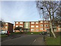
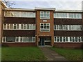
Residents of B29 6SL have access to a range of educational institutions. Dame Elizabeth Cadbury Technology College is a primary school with a focus on technical education, while Fircroft College of Adult Education provides sixth-form and further education opportunities. Nearby, Dame Elizabeth Cadbury School operates as an academy with a Good Ofsted rating, offering secondary education. This mix of school types supports families at different stages of education, from early years to post-16 learning. The presence of a high-performing academy suggests strong academic provision, though parents should consider specific school catchment areas and transportation needs. The variety of educational options reflects the area’s historical ties to the Cadbury legacy and its continued investment in community infrastructure.
| Rank | School | Type | Entry gender | Ages |
|---|
Explore more schools in this area
Go to Schools tabDemographics
The population of B29 6SL is 1,544, with a median age of 47 and the majority of residents aged 30–64. This suggests a community skewed toward adults, likely including families and professionals. Home ownership stands at 55%, with houses being the predominant accommodation type. The predominant ethnic group is White, reflecting the area’s historical and cultural ties to its Quaker founders and local heritage. The age profile indicates a stable, mature population, which may influence local services and amenities. With no specific data on deprivation, the area’s low crime risk (Safety Score 67/100) and lack of environmental constraints suggest a relatively high quality of life. The demographic mix supports a community-oriented environment, with schools and amenities tailored to adult and family needs rather than younger populations.
Household Size
Accommodation Type
Tenure
Ethnic Group
Religion
Household Composition
Age
Household Deprivation
NS-SEC
Explore more demographic insights in this area
Go to Demographics tabPlanning
Planning Constraints
- Flood RiskPremium
- Ramsar Wetland SitesPremium
- Area of Outstanding Natural BeautyPremium
- Protected Nature ReservePremium
- Protected WoodlandPremium