Area Overview for B29 6HE
Photos of B29 6HE
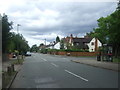
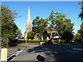
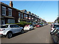
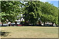
45 photos from this area
Area Information
Key information about the B29 6HE including its size, population, and administrative classification.
- Area Type
- Postcode
- Area Size
- 2962 m²
- Population
- 2434
- Population Density
- 19318 people/km²
House Prices in B29 6HE
13
Properties
£180,500
Average Sold Price
£55,000
Lowest Price
£260,000
Highest Price
Showing 13 properties
| Address | Type | Beds | Baths | Last Sale Price | Last Sale Date | |
|---|---|---|---|---|---|---|
| 69E Raddlebarn Road, Birmingham, B29 6HE | house | 4 | 3 | £260,000 | Feb 2022 | |
| 69B Raddlebarn Road, Birmingham, B29 6HE | house | - | - | £210,000 | Aug 2020 | |
| 69G Raddlebarn Road, Birmingham, B29 6HE | Terraced | 4 | 2 | £197,000 | Jun 2020 | |
| 69H Raddlebarn Road, Birmingham, B29 6HE | Terraced | 3 | - | £55,000 | Dec 1996 | |
| 69A Raddlebarn Road, Birmingham, B29 6HE | Terraced | 3 | 1 | - | - | |
| Flat 5, Raddlebarn Court, 71A Raddlebarn Road, Birmingham, B29 6HE | house | 7 | 2 | - | - | |
| Flat 3, Raddlebarn Court, 71A Raddlebarn Road, Birmingham, B29 6HE | house | 7 | 3 | - | - | |
| 69F Raddlebarn Road, Birmingham, B29 6HE | Terraced | 5 | - | - | - | |
| 69D Raddlebarn Road, Birmingham, B29 6HE | Terraced | - | - | - | - | |
| 69C Raddlebarn Road, Birmingham, B29 6HE | house | - | - | - | - |
Page 1 of 2
Energy Efficiency in B29 6HE
Amenities
Schools
| Rank | School | Type | Entry gender | Ages |
|---|
Explore more schools in this area
Go to Schools tabDemographics
Household Size
Family (3-5 people)
most common
Accommodation Type
Houses
most common
Tenure
7
majority
Ethnic Group
White
most common
Religion
N/A
most common
Household Composition
N/A
most common
Age
22
median
Young Adults (15-29 years)
most common
Household Deprivation
N/A
with no deprivation
NS-SEC
3
in Lower managerial occupations
Explore more demographic insights in this area
Go to Demographics tabPlanning
Planning Constraints
- Flood RiskPremium
- Ramsar Wetland SitesPremium
- Area of Outstanding Natural BeautyPremium
- Protected Nature ReservePremium
- Protected WoodlandPremium