Area Overview for B29 6GA
Photos of B29 6GA
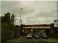
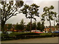
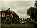
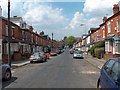
100 photos from this area
Area Information
Key information about the B29 6GA including its size, population, and administrative classification.
- Area Type
- Postcode
- Area Size
- 1.8 hectares
- Population
- 4344
- Population Density
- 6555 people/km²
House Prices in B29 6GA
60
Properties
£301,143
Average Sold Price
£225,000
Lowest Price
£386,000
Highest Price
Showing 60 properties
| Address | Type | Beds | Baths | Last Sale Price | Last Sale Date | |
|---|---|---|---|---|---|---|
| 20 Arkell Way, Birmingham, B29 6GA | Semi-detached | 3 | 2 | £375,000 | Mar 2025 | |
| 25 Arkell Way, Birmingham, B29 6GA | Semi-detached | 3 | 2 | £365,000 | Mar 2025 | |
| 41 Arkell Way, Birmingham, B29 6GA | Terraced | 3 | 2 | £295,000 | Nov 2024 | |
| 57 Arkell Way, Birmingham, B29 6GA | house | - | - | £315,000 | Sep 2024 | |
| 68 Arkell Way, Birmingham, B29 6GA | house | - | - | £225,000 | Apr 2024 | |
| 74 Arkell Way, Birmingham, B29 6GA | Semi-detached | 1 | 2 | £240,000 | Mar 2024 | |
| 59 Arkell Way, Birmingham, B29 6GA | Semi-detached | 3 | 2 | £357,000 | Jun 2023 | |
| 66 Arkell Way, Birmingham, B29 6GA | house | - | - | £310,000 | Jun 2023 | |
| 33 Arkell Way, Birmingham, B29 6GA | house | 3 | 1 | £338,000 | Jan 2023 | |
| 50 Arkell Way, Birmingham, B29 6GA | house | - | - | £386,000 | Dec 2021 |
Page 1 of 6
Energy Efficiency in B29 6GA
Amenities
Schools
| Rank | School | Type | Entry gender | Ages |
|---|
Explore more schools in this area
Go to Schools tabDemographics
Household Size
Family (3-5 people)
most common
Accommodation Type
Houses
most common
Tenure
35
majority
Ethnic Group
White
most common
Religion
N/A
most common
Household Composition
N/A
most common
Age
22
median
Young Adults (15-29 years)
most common
Household Deprivation
N/A
with no deprivation
NS-SEC
11
in Lower managerial occupations
Explore more demographic insights in this area
Go to Demographics tabPlanning
Planning Constraints
- Flood RiskPremium
- Ramsar Wetland SitesPremium
- Area of Outstanding Natural BeautyPremium
- Protected Nature ReservePremium
- Protected WoodlandPremium