Area Overview for B29 6AN
Photos of B29 6AN

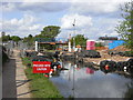
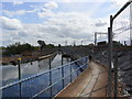


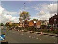

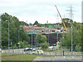
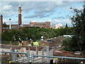

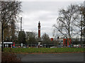
100 photos from this area
Area Information
Key information about the B29 6AN including its size, population, and administrative classification.
- Area Type
- Postcode
- Area Size
- 5495 m²
- Population
- 2182
- Population Density
- 17195 people/km²
House Prices in B29 6AN
60
Properties
£211,129
Average Sold Price
£34,750
Lowest Price
£520,000
Highest Price
Showing 60 properties
| Address | Type | Beds | Baths | Last Sale Price | Last Sale Date | |
|---|---|---|---|---|---|---|
| 73 North Road, Selly Oak, Birmingham, B29 6AN | Terraced | 3 | - | £520,000 | Jun 2024 | |
| 49 North Road, Selly Oak, Birmingham, B29 6AN | Retail | 3 | 1 | £315,000 | Oct 2022 | |
| 79 North Road, Selly Oak, Birmingham, B29 6AN | Terraced | 4 | 1 | £260,000 | Sep 2021 | |
| 81 North Road, Selly Oak, Birmingham, B29 6AN | Terraced | 4 | 1 | £260,000 | Sep 2021 | |
| 25 North Road, Selly Oak, Birmingham, B29 6AN | house | - | - | £280,000 | Dec 2018 | |
| 41 North Road, Selly Oak, Birmingham, B29 6AN | house | 3 | 1 | £400,000 | Nov 2018 | |
| 59 North Road, Selly Oak, Birmingham, B29 6AN | house | 7 | - | £385,000 | Nov 2018 | |
| 7 North Road, Selly Oak, Birmingham, B29 6AN | house | 7 | 1 | £360,000 | Aug 2017 | |
| 15 North Road, Selly Oak, Birmingham, B29 6AN | Terraced | 1 | 1 | £300,000 | Feb 2017 | |
| 63 North Road, Selly Oak, Birmingham, B29 6AN | Terraced | 3 | - | £236,000 | Oct 2016 |
Page 1 of 6
Energy Efficiency in B29 6AN
Amenities
Schools
| Rank | School | Type | Entry gender | Ages |
|---|
Explore more schools in this area
Go to Schools tabDemographics
Household Size
Family (3-5 people)
most common
Accommodation Type
Houses
most common
Tenure
10
majority
Ethnic Group
White
most common
Religion
N/A
most common
Household Composition
N/A
most common
Age
22
median
Young Adults (15-29 years)
most common
Household Deprivation
N/A
with no deprivation
NS-SEC
5
in Lower managerial occupations
Explore more demographic insights in this area
Go to Demographics tabPlanning
Planning Constraints
- Flood RiskPremium
- Ramsar Wetland SitesPremium
- Area of Outstanding Natural BeautyPremium
- Protected Nature ReservePremium
- Protected WoodlandPremium