Area Overview for B29 5TE
Photos of B29 5TE
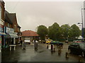
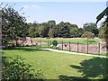
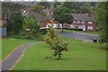

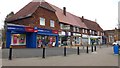

26 photos from this area
Area Information
Key information about the B29 5TE including its size, population, and administrative classification.
- Area Type
- Postcode
- Area Size
- 1.4 hectares
- Population
- 1515
- Population Density
- 4215 people/km²
House Prices in B29 5TE
18
Properties
£104,500
Average Sold Price
£99,000
Lowest Price
£110,000
Highest Price
Showing 18 properties
| Address | Type | Beds | Baths | Last Sale Price | Last Sale Date | |
|---|---|---|---|---|---|---|
| 117 Bottetourt Road, Bartley Green, Birmingham, B29 5TE | Semi-detached | - | - | £99,000 | Jan 2007 | |
| 115 Bottetourt Road, Bartley Green, Birmingham, B29 5TE | Semi-detached | - | - | £110,000 | May 2006 | |
| MIDLAND MENCAP, BOTTETOURT ROAD, Weoley, Birmingham, B29 5TE | Unknown | - | - | - | - | |
| 117A Bottetourt Road, Bartley Green, Birmingham, B29 5TE | Mobile Home | - | - | - | - | |
| 151 Bottetourt Road, Bartley Green, Birmingham, B29 5TE | Bungalow | - | - | - | - | |
| 113 Bottetourt Road, Bartley Green, Birmingham, B29 5TE | Semi-detached | - | - | - | - | |
| 139 Bottetourt Road, Bartley Green, Birmingham, B29 5TE | Bungalow | - | - | - | - | |
| 137 Bottetourt Road, Bartley Green, Birmingham, B29 5TE | Bungalow | - | - | - | - | |
| 131 Bottetourt Road, Bartley Green, Birmingham, B29 5TE | Bungalow | - | - | - | - | |
| 133 Bottetourt Road, Bartley Green, Birmingham, B29 5TE | Bungalow | - | - | - | - |
Page 1 of 2
Energy Efficiency in B29 5TE
Amenities
Schools
| Rank | School | Type | Entry gender | Ages |
|---|
Explore more schools in this area
Go to Schools tabDemographics
Household Size
Family (3-5 people)
most common
Accommodation Type
Houses
most common
Tenure
44
majority
Ethnic Group
White
most common
Religion
N/A
most common
Household Composition
N/A
most common
Age
47
median
Adults (30-64 years)
most common
Household Deprivation
N/A
with no deprivation
NS-SEC
20
in Lower managerial occupations
Explore more demographic insights in this area
Go to Demographics tabPlanning
Planning Constraints
- Flood RiskPremium
- Ramsar Wetland SitesPremium
- Area of Outstanding Natural BeautyPremium
- Protected Nature ReservePremium
- Protected WoodlandPremium