Area Overview for B29 5RE
Photos of B29 5RE
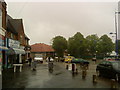
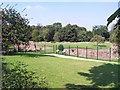
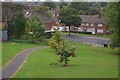

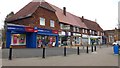
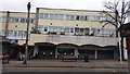
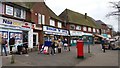
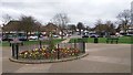

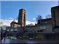
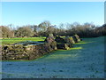
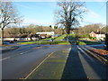
26 photos from this area
Area Information
Key information about the B29 5RE including its size, population, and administrative classification.
- Area Type
- Postcode
- Area Size
- 1.2 hectares
- Population
- 1447
- Population Density
- 5979 people/km²
House Prices in B29 5RE
41
Properties
£105,219
Average Sold Price
£36,500
Lowest Price
£185,000
Highest Price
Showing 41 properties
| Address | Type | Beds | Baths | Last Sale Price | Last Sale Date | |
|---|---|---|---|---|---|---|
| 17 Hopstone Road, Birmingham, B29 5RE | Terraced | 2 | 1 | £170,000 | Oct 2024 | |
| 45 Hopstone Road, Birmingham, B29 5RE | house | - | - | £168,000 | May 2023 | |
| 21 Hopstone Road, Birmingham, B29 5RE | Terraced | 2 | 1 | £185,000 | Jul 2022 | |
| 33 Hopstone Road, Birmingham, B29 5RE | Terraced | 2 | 1 | £153,000 | May 2020 | |
| 43 Hopstone Road, Birmingham, B29 5RE | Terraced | 3 | 1 | £129,950 | Sep 2018 | |
| 67 Hopstone Road, Birmingham, B29 5RE | house | - | - | £125,000 | Aug 2016 | |
| 69 Hopstone Road, Birmingham, B29 5RE | Semi-detached | 2 | 1 | £139,950 | Oct 2015 | |
| 29 Hopstone Road, Birmingham, B29 5RE | house | 2 | - | £94,000 | Aug 2013 | |
| 5 Hopstone Road, Birmingham, B29 5RE | house | - | - | £88,000 | Nov 2012 | |
| 15 Hopstone Road, Birmingham, B29 5RE | Terraced | 2 | 1 | £76,150 | Jun 2012 |
Page 1 of 5
Energy Efficiency in B29 5RE
Amenities
Schools
| Rank | School | Type | Entry gender | Ages |
|---|
Explore more schools in this area
Go to Schools tabDemographics
Household Size
One person
most common
Accommodation Type
Houses
most common
Tenure
52
majority
Ethnic Group
White
most common
Religion
N/A
most common
Household Composition
N/A
most common
Age
47
median
Adults (30-64 years)
most common
Household Deprivation
N/A
with no deprivation
NS-SEC
20
in Lower managerial occupations
Explore more demographic insights in this area
Go to Demographics tabPlanning
Planning Constraints
- Flood RiskPremium
- Ramsar Wetland SitesPremium
- Area of Outstanding Natural BeautyPremium
- Protected Nature ReservePremium
- Protected WoodlandPremium