Area Overview for B29 5QB
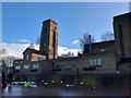
Photos of B29 5QB

Area Information
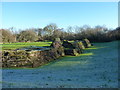
B29 5QB is a specific postcode area covering a small residential cluster within the larger Weoley & Selly Oak ward. This ward occupies the south west of Birmingham, England, and spans a vast region that includes communities like Selly Park, Bournbrook, and Spicelands Road. Despite its large administrative footprint, this specific postcode covers only 6728 m² of land. It is home to 1521 people, creating a densely packed living environment. Living in B29 5QB means residing in a neighbourhood where every square metre is occupied, yet it remains part of a broader suburban setting established since at least 1746. The area was formally merged into Birmingham City Council in 1911 under the Greater Birmingham Act, separating it from Worcestershire. The history here is deep, marked by landmarks like the historic oak tree in Selly Oak Park which grew between 1710 and 1720. Today, you find yourself in a community that balances a long past with modern suburban life. The ward holds a population of approximately 23,511, making it the 10th most populous ward in Birmingham. Within this specific postcode, you are part of a tightly knit group of residents sharing the same immediate streets while having access to the wider community facilities of Weoley Castle and Ten Acres. The area is distinct for its high density combined with its historical significance as a hub that once housed Carey Hall and Selly Oak Hospital.
- Area Type
- Postcode
- Area Size
- 6728 m²
- Population
- 1521
- Population Density
- 5419 people/km²
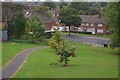
Homes in B29 5QB consist primarily of houses, which aligns with the established suburban architecture of the Weoley & Selly Oak ward. The housing stock reflects a significant period of development following the area's integration into Birmingham in 1911, resulting in streets lined with residential properties rather than commercial blocks. With a home ownership rate of 42%, the market presents a mixed landscape where both owner-occupiers and landlords coexist. This split suggests that while many residents have built equity in their properties, a substantial portion of the population relies on the rental market. Buyers looking at this specific postcode should expect a range of house types suitable for adults aged 30 to 64, the most common age range in the locality. The small land area of 6728 m² indicates that properties are situated close together, which can be appealing for community interaction but may limit private garden space compared to larger areas. The 42% ownership figure implies a vibrant but competitive rental segment alongside the residential core. Prospective buyers should research individual properties carefully as the specific layout within this dense cluster can vary. Understanding the balance between owned and rented stock is essential when navigating the property landscape around schools like Jervoise School and retail hubs such as Heron Weoley.
House Prices in B29 5QB
No properties found in this postcode.
Energy Efficiency in B29 5QB
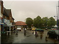
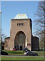
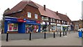
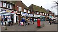
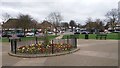
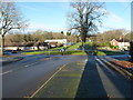
Residents of B29 5QB enjoy convenient access to a variety of local amenities that serve daily needs without requiring long journeys. Within practical reach are five retail outlets, including notable venues such as Heron Weoley, Asda Barnes, and Iceland Selly. These shops provide everything from grocery essentials to general shopping, fitting into the routine of a community where adult life is the norm. Transport links are equally accessible, with five nearby railway stations connecting you to Selly Oak Railway Station, University Railway Station, and Bournville Railway Station. This network facilitates easy travel to other parts of Birmingham. Additionally, five metro stations are nearby, including Edgbaston Village, Centenary Square, and Town Hall, ensuring comprehensive public transport access. The area also features historic landmarks such as Selly Oak Park, which contains the famous oak tree from the early 18th century, and the community centre at Weoley Castle. St Gabriel's Church on Marston Road and Elim Church at Castle Square offer places of worship for the predominantly White community. These facilities are located within the Weoley & Selly Oak ward, which covers a wider area including Spicelands Road and Allens Cross. The lifestyle is defined by proximity, allowing you to reach essential services quickly while remaining rooted in a neighbourhood with deep historical ties dating back to 1727.
Amenities
Schools
Families living in B29 5QB have access to a range of educational institutions nearby, catering to early childhood through primary education. Edith Cadbury Nursery School is available for younger children, providing care for the earliest stages of development. For primary education, Principethorpe Infant School and Principethorpe Junior School offer a continuous local option, allowing children to attend both infant and junior sections within the same institution. Additionally, Jervoise School serves the area as both a primary academy and a standalone primary institution, offering an alternative education model for local families. The presence of these specific schools means that raised school fees or transport costs to larger secondary colleges may be less of a concern for many in this postcode. All listed facilities are recognised educational bodies located within practical commuting distance of the 6728 m² cluster. The mix of a nursery, multiple primary schools, and an academy provides flexibility for parents choosing an educational path. These schools are integrated into the daily life of the Weoley ward, where the community is largely composed of adults. The proximity of Princethorpe and Jervoise ensures that children raised in this dense area can access education without leaving their immediate neighbourhood boundaries.
| Rank | School | Type | Entry gender | Ages |
|---|
Explore more schools in this area
Go to Schools tabDemographics
The community in B29 5QB reflects a mature population where adults are the central group. The median age stands at 47 years, confirming that the area is predominantly populated by adults between 30 and 64 years old. This age profile suggests a settlement that attracts families in their established years or retirees seeking stability. The population density reaches 226,070 people per km², indicating a compact living arrangement where neighbours are physically close. Home ownership rates sit at 42%, meaning nearly half of the residents own their homes outright while the remainder likely rent. Houses form the primary accommodation type within this postcode, offering detached or semi-detached living arrangements typical of suburban Birmingham. Racial demographics show that White residents form the predominant ethnic group, a statistic that mirrors the wider character of the Weoley ward where 80% of the population was identified as White in the 2011 census. This consistency highlights a culturally familiar environment where local traditions and community structures have remained relatively stable since the ward was created in 1950. The high density and age mix create a settled atmosphere where long-term residents often know one another well.
Household Size
Accommodation Type
Tenure
Ethnic Group
Religion
Household Composition
Age
Household Deprivation
NS-SEC
Explore more demographic insights in this area
Go to Demographics tabPlanning
Planning Constraints
- Flood RiskPremium
- Ramsar Wetland SitesPremium
- Area of Outstanding Natural BeautyPremium
- Protected Nature ReservePremium
- Protected WoodlandPremium