Area Overview for B29 5PN
Photos of B29 5PN
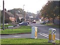
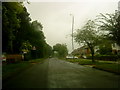
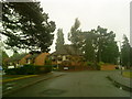
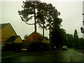
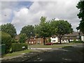
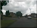

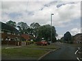
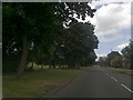
46 photos from this area
Area Information
Key information about the B29 5PN including its size, population, and administrative classification.
- Area Type
- Postcode
- Area Size
- 1.2 hectares
- Population
- 1447
- Population Density
- 5979 people/km²
House Prices in B29 5PN
28
Properties
£136,462
Average Sold Price
£35,000
Lowest Price
£213,000
Highest Price
Showing 28 properties
| Address | Type | Beds | Baths | Last Sale Price | Last Sale Date | |
|---|---|---|---|---|---|---|
| 78 Shenley Lane, Bartley Green, Birmingham, B29 5PN | Detached | 3 | 1 | £190,000 | May 2022 | |
| 60 Shenley Lane, Bartley Green, Birmingham, B29 5PN | Semi-detached | 3 | 1 | £213,000 | Sep 2021 | |
| 62 Shenley Lane, Bartley Green, Birmingham, B29 5PN | Semi-detached | 3 | - | £157,000 | Nov 2018 | |
| 72 Shenley Lane, Bartley Green, Birmingham, B29 5PN | Semi-detached | 3 | 1 | £142,000 | Jul 2018 | |
| 88 Shenley Lane, Bartley Green, Birmingham, B29 5PN | Semi-detached | 3 | 1 | £180,000 | Sep 2017 | |
| 46 Shenley Lane, Bartley Green, Birmingham, B29 5PN | house | - | - | £145,000 | Aug 2016 | |
| 64 Shenley Lane, Bartley Green, Birmingham, B29 5PN | Semi-detached | 3 | 1 | £147,000 | Jul 2016 | |
| 54 Shenley Lane, Bartley Green, Birmingham, B29 5PN | house | 3 | - | £112,000 | Nov 2014 | |
| 74 Shenley Lane, Bartley Green, Birmingham, B29 5PN | Semi-detached | 3 | - | £105,000 | May 2009 | |
| 82 Shenley Lane, Bartley Green, Birmingham, B29 5PN | Semi-detached | - | - | £35,000 | Mar 2009 |
Page 1 of 3
Energy Efficiency in B29 5PN
Amenities
Schools
| Rank | School | Type | Entry gender | Ages |
|---|
Explore more schools in this area
Go to Schools tabDemographics
Household Size
One person
most common
Accommodation Type
Houses
most common
Tenure
52
majority
Ethnic Group
White
most common
Religion
N/A
most common
Household Composition
N/A
most common
Age
47
median
Adults (30-64 years)
most common
Household Deprivation
N/A
with no deprivation
NS-SEC
20
in Lower managerial occupations
Explore more demographic insights in this area
Go to Demographics tabPlanning
Planning Constraints
- Flood RiskPremium
- Ramsar Wetland SitesPremium
- Area of Outstanding Natural BeautyPremium
- Protected Nature ReservePremium
- Protected WoodlandPremium