Area Overview for B29 4PD
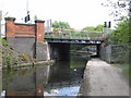
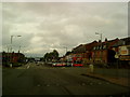
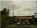
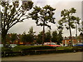
Photos of B29 4PD


Area Information
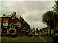
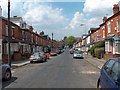
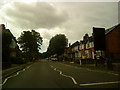
Living in B29 4PD means inhabiting a small, tightly knit residential cluster in the southwest of Birmingham, where history and modernity intersect. The area, part of the Bournville & Cotteridge Ward, blends the planned garden village of Bournville—with its tree-lined streets and conservation status—with Cotteridge’s older rural roots. With a population of 4,344, the community is young, with a median age of 22, and dominated by young adults aged 15–29. This reflects a dynamic, possibly student or early-career population, shaped by proximity to educational hubs and historic industrial landmarks. The area’s character is defined by low-density housing, green spaces, and a heritage of Quaker-led planning. Residents benefit from proximity to the Cadbury chocolate factory, a key employer, and the Bournville Village Trust’s ongoing stewardship of the estate. Daily life here is punctuated by the legacy of 19th-century model village design, with a focus on community and outdoor living, though the area’s small size means it is best suited for those prioritising local charm over urban sprawl.
- Area Type
- Postcode
- Area Size
- Not available
- Population
- 4344
- Population Density
- 6555 people/km²
The property market in B29 4PD is characterised by a low home ownership rate of 35%, suggesting that a majority of properties are rented rather than owned. The accommodation type is predominantly houses, which is unusual for a small postcode area but aligns with the broader Bournville estate’s planned garden village design. This focus on houses rather than flats or apartments may appeal to buyers seeking larger, family-friendly homes with private gardens. However, the small size of the area means the housing stock is limited, and competition for properties could be intense. For buyers, this presents a niche market where availability is constrained, and prices may reflect the area’s historical and conservation value. The low home ownership rate also indicates that renters form a significant portion of the population, which could influence the local rental market’s dynamics and property management trends.
House Prices in B29 4PD
No properties found in this postcode.
Energy Efficiency in B29 4PD
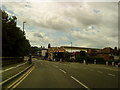
Residents of B29 4PD have access to a range of amenities within practical reach. The area is served by five railway stations, including Selly Oak and Bournville, providing direct links to Birmingham’s transport network. Retail options include Iceland Selly, Sainsburys Selly, and Aldi Selly, offering everyday shopping convenience. Nearby metro areas like Edgbaston Village and Centenary Square add to the area’s accessibility, supporting both commuting and leisure activities. The historical and cultural fabric of the area, including the Cadbury chocolate factory and Bournville Park, contributes to a unique lifestyle that blends heritage with suburban comfort. While the data does not specify dining or leisure venues, the proximity to larger Birmingham districts suggests a broader range of options for residents seeking more diverse experiences.
Amenities
Schools
The nearest school to B29 4PD is Cherry Oak School, which is designated as a special school. No other schools are listed in the data for this area. This suggests a limited range of educational options, which may be a consideration for families requiring mainstream schooling. The presence of a special school indicates a focus on supporting students with specific needs, but it does not provide information on the availability of primary or secondary schools for the broader population. Families seeking a wider range of educational institutions may need to look beyond the immediate vicinity. The absence of data on school Ofsted ratings means that the quality of education cannot be assessed from this information alone.
| Rank | School | Type | Entry gender | Ages |
|---|---|---|---|---|
| 1 | Cherry Oak School | special | N/A | N/A |
Explore more schools in this area
Go to Schools tabDemographics
The population of B29 4PD is overwhelmingly young, with a median age of 22 and the most common age range being 15–29 years. This suggests a community shaped by students, early-career professionals, or families with young children. Home ownership here is relatively low at 35%, indicating a higher proportion of rental properties compared to owner-occupied homes. The accommodation type is predominantly houses, which aligns with the area’s suburban, low-density character. The predominant ethnic group is White, though specific data on diversity beyond this is not provided. The young demographic profile may influence local services and amenities, with a focus on education and employment opportunities. The lower home ownership rate could reflect a transient population or a market where rental demand outstrips supply. This profile also implies a community with evolving needs, potentially requiring investment in housing diversity and long-term infrastructure.
Household Size
Accommodation Type
Tenure
Ethnic Group
Religion
Household Composition
Age
Household Deprivation
NS-SEC
Explore more demographic insights in this area
Go to Demographics tabPlanning
Planning Constraints
- Flood RiskPremium
- Ramsar Wetland SitesPremium
- Area of Outstanding Natural BeautyPremium
- Protected Nature ReservePremium
- Protected WoodlandPremium
- Crime RiskPremium