Area Overview for B29 4ER
Photos of B29 4ER
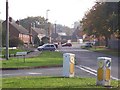
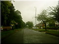
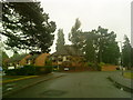
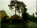
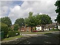
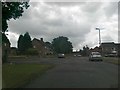

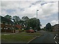
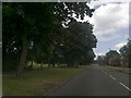
46 photos from this area
Area Information
Key information about the B29 4ER including its size, population, and administrative classification.
- Area Type
- Postcode
- Area Size
- 9400 m²
- Population
- 1474
- Population Density
- 3049 people/km²
House Prices in B29 4ER
22
Properties
£147,996
Average Sold Price
£7,500
Lowest Price
£200,000
Highest Price
Showing 22 properties
| Address | Type | Beds | Baths | Last Sale Price | Last Sale Date | |
|---|---|---|---|---|---|---|
| 41 Peach Ley Road, Birmingham, B29 4ER | house | - | - | £200,000 | Jul 2021 | |
| 65 Peach Ley Road, Birmingham, B29 4ER | Terraced | 3 | 1 | £190,000 | Jan 2021 | |
| 25 Peach Ley Road, Birmingham, B29 4ER | Semi-detached | 3 | 1 | £178,000 | Oct 2020 | |
| 35 Peach Ley Road, Birmingham, B29 4ER | Terraced | 3 | 1 | £190,000 | Dec 2019 | |
| 61 Peach Ley Road, Birmingham, B29 4ER | Terraced | 3 | - | £192,000 | Oct 2018 | |
| 53 Peach Ley Road, Birmingham, B29 4ER | Terraced | 3 | 1 | £163,000 | Apr 2018 | |
| 63 Peach Ley Road, Birmingham, B29 4ER | Terraced | - | - | £7,500 | Jul 2017 | |
| 23 Peach Ley Road, Birmingham, B29 4ER | Semi-detached | 3 | 1 | £200,000 | Jul 2017 | |
| 57 Peach Ley Road, Birmingham, B29 4ER | Terraced | 3 | - | £195,000 | Aug 2016 | |
| 37 Peach Ley Road, Birmingham, B29 4ER | Terraced | 3 | 1 | £139,000 | Dec 2013 |
Page 1 of 3
Energy Efficiency in B29 4ER
Amenities
Schools
| Rank | School | Type | Entry gender | Ages |
|---|
Explore more schools in this area
Go to Schools tabDemographics
Household Size
Family (3-5 people)
most common
Accommodation Type
Houses
most common
Tenure
80
majority
Ethnic Group
White
most common
Religion
N/A
most common
Household Composition
N/A
most common
Age
47
median
Adults (30-64 years)
most common
Household Deprivation
N/A
with no deprivation
NS-SEC
37
in Lower managerial occupations
Explore more demographic insights in this area
Go to Demographics tabPlanning
Planning Constraints
- Flood RiskPremium
- Ramsar Wetland SitesPremium
- Area of Outstanding Natural BeautyPremium
- Protected Nature ReservePremium
- Protected WoodlandPremium