Area Overview for B29 4DR
Photos of B29 4DR

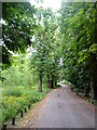
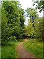
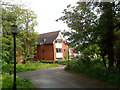
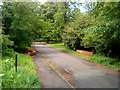
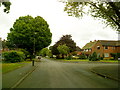
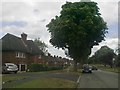

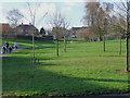
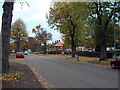
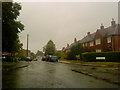
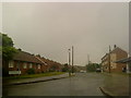
47 photos from this area
Area Information
Key information about the B29 4DR including its size, population, and administrative classification.
- Area Type
- Postcode
- Area Size
- 2.0 hectares
- Population
- 1492
- Population Density
- 3952 people/km²
House Prices in B29 4DR
45
Properties
£230,245
Average Sold Price
£72,500
Lowest Price
£460,000
Highest Price
Showing 45 properties
| Address | Type | Beds | Baths | Last Sale Price | Last Sale Date | |
|---|---|---|---|---|---|---|
| 138 Green Meadow Road, Birmingham, B29 4DR | Semi-detached | 3 | 1 | £330,000 | Mar 2023 | |
| 96 Green Meadow Road, Birmingham, B29 4DR | Semi-detached | 3 | - | £460,000 | Sep 2021 | |
| 182 Green Meadow Road, Birmingham, B29 4DR | Detached | 3 | 1 | £225,000 | Jan 2021 | |
| 170 Green Meadow Road, Birmingham, B29 4DR | Semi-detached | 3 | 1 | £216,930 | Dec 2020 | |
| 154 Green Meadow Road, Birmingham, B29 4DR | Semi-detached | 3 | 1 | £234,000 | Nov 2020 | |
| 158 Green Meadow Road, Birmingham, B29 4DR | Semi-detached | 3 | 1 | £225,000 | May 2020 | |
| 174 Green Meadow Road, Birmingham, B29 4DR | Semi-detached | 3 | 1 | £237,500 | Jan 2019 | |
| 156 Green Meadow Road, Birmingham, B29 4DR | Semi-detached | 3 | 1 | £245,000 | May 2018 | |
| 102 Green Meadow Road, Birmingham, B29 4DR | Semi-detached | 4 | - | £295,000 | Sep 2017 | |
| 172 Green Meadow Road, Birmingham, B29 4DR | Semi-detached | 4 | - | £280,000 | Jul 2017 |
Page 1 of 5
Energy Efficiency in B29 4DR
Amenities
Schools
| Rank | School | Type | Entry gender | Ages |
|---|
Explore more schools in this area
Go to Schools tabDemographics
Household Size
Family (3-5 people)
most common
Accommodation Type
Houses
most common
Tenure
80
majority
Ethnic Group
White
most common
Religion
N/A
most common
Household Composition
N/A
most common
Age
47
median
Adults (30-64 years)
most common
Household Deprivation
N/A
with no deprivation
NS-SEC
42
in Lower managerial occupations
Explore more demographic insights in this area
Go to Demographics tabPlanning
Planning Constraints
- Flood RiskPremium
- Ramsar Wetland SitesPremium
- Area of Outstanding Natural BeautyPremium
- Protected Nature ReservePremium
- Protected WoodlandPremium