Area Overview for B28 9RL
Photos of B28 9RL
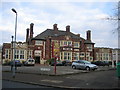
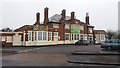
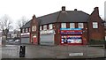
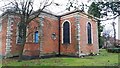
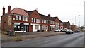
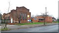
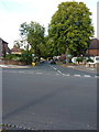
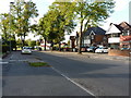
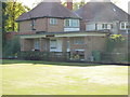
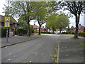
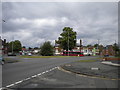
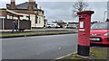
21 photos from this area
Area Information
Key information about the B28 9RL including its size, population, and administrative classification.
- Area Type
- Postcode
- Area Size
- 9521 m²
- Population
- 1922
- Population Density
- 8210 people/km²
House Prices in B28 9RL
32
Properties
£133,821
Average Sold Price
£36,500
Lowest Price
£230,000
Highest Price
Showing 32 properties
| Address | Type | Beds | Baths | Last Sale Price | Last Sale Date | |
|---|---|---|---|---|---|---|
| 160 Mapleton Road, Birmingham, B28 9RL | Terraced | 2 | 1 | £181,300 | Jan 2025 | |
| 175 Mapleton Road, Birmingham, B28 9RL | house | - | - | £215,000 | Jan 2025 | |
| 167 Mapleton Road, Birmingham, B28 9RL | Terraced | 3 | 1 | £186,500 | Nov 2023 | |
| 185 Mapleton Road, Birmingham, B28 9RL | house | - | - | £230,000 | Aug 2023 | |
| 157 Mapleton Road, Birmingham, B28 9RL | house | 3 | 2 | £145,000 | Aug 2014 | |
| 171 Mapleton Road, Birmingham, B28 9RL | house | - | - | £132,000 | Nov 2012 | |
| 164 Mapleton Road, Birmingham, B28 9RL | house | 3 | - | £95,000 | Jun 2011 | |
| 195 Mapleton Road, Birmingham, B28 9RL | house | - | - | £115,000 | Sep 2010 | |
| 165 Mapleton Road, Birmingham, B28 9RL | house | - | - | £117,000 | Nov 2009 | |
| 177 Mapleton Road, Birmingham, B28 9RL | Terraced | 3 | 1 | £113,000 | Jun 2005 |
Page 1 of 4
Energy Efficiency in B28 9RL
Amenities
Schools
| Rank | School | Type | Entry gender | Ages |
|---|
Explore more schools in this area
Go to Schools tabDemographics
Household Size
Family (3-5 people)
most common
Accommodation Type
Houses
most common
Tenure
45
majority
Ethnic Group
White
most common
Religion
N/A
most common
Household Composition
N/A
most common
Age
47
median
Adults (30-64 years)
most common
Household Deprivation
N/A
with no deprivation
NS-SEC
18
in Lower managerial occupations
Explore more demographic insights in this area
Go to Demographics tabPlanning
Planning Constraints
- Flood RiskPremium
- Ramsar Wetland SitesPremium
- Area of Outstanding Natural BeautyPremium
- Protected Nature ReservePremium
- Protected WoodlandPremium