Area Overview for B28 9PR
Photos of B28 9PR

Area Information
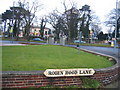
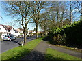
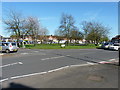
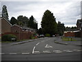
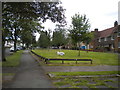
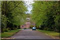
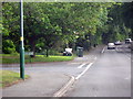
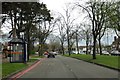
B28 9PR is a small, tightly packed postcode area within Birmingham’s Hall Green district, known for its suburban charm and historical significance. Covering just 2,614 square metres, it is home to 1,922 residents, creating a densely populated yet intimate community. The area blends early 20th-century architecture with interwar housing, many set back from roads behind low red brick walls and tree-lined streets. Hall Green North Ward, where B28 9PR lies, is part of a broader area recognised as one of Birmingham’s safest districts. Residents benefit from a mix of residential tranquillity and proximity to modern amenities. The ward’s history includes 19th-century developments like The Hamlet, a private villa estate with distinctive Victorian features, and historic landmarks such as the Church of the Ascension (1704). Daily life here is shaped by a mature demographic, with a median age of 47 and a focus on family-oriented living. The area’s low crime rate and strong community ties make it appealing for those seeking a balance between heritage and contemporary convenience.
- Area Type
- Postcode
- Area Size
- 2614 m²
- Population
- 1922
- Population Density
- 8210 people/km²
B28 9PR is characterised by a predominance of houses, with 45% of residents owning their homes. This suggests a mix of owner-occupied properties and rental units, though the exact proportion of rentals is not specified. The housing stock reflects early 20th-century to interwar architecture, with many homes featuring red brick facades, timber detailing, and mature gardens. Notable examples include Petersfield Court, an Art Deco block of 14 flats, and The Hamlet, a 19th-century villa estate. The compact nature of the area means the housing market is limited to a small cluster of properties, potentially increasing competition among buyers. For those seeking homes in B28 9PR, the focus is on period properties with historical character rather than modern developments. The area’s safety and established infrastructure make it attractive for buyers prioritising security and convenience, though the limited size of the postcode may require considering nearby areas for additional options.
House Prices in B28 9PR
No properties found in this postcode.
Energy Efficiency in B28 9PR
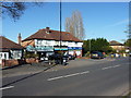
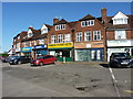
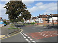
Living in B28 9PR offers access to a range of amenities that support both daily convenience and community engagement. Retail options include Co-op Northfield, Aldi Hall, and Waitrose Hall, providing essential shopping within easy reach. The area’s proximity to rail stations such as Hall Green and Yardley Wood, along with metro connections to Birmingham International Airport and Grand Central New Street, ensures seamless travel for commuting or leisure. While specific parks or green spaces are not detailed in the data, the area’s historical character includes tree-lined streets and mature gardens, suggesting a pleasant outdoor environment. The presence of cultural landmarks like the Friends Meeting House and the Church of the Ascension adds to the area’s distinct identity. Overall, the mix of retail, transport, and historical features creates a lifestyle that balances practicality with a sense of place.
Amenities
Schools
B28 9PR is served by two schools: Robin Hood Junior and Infant School, a primary school, and Robin Hood Academy, an academy. Both institutions are located within the broader Hall Green area, which has a long-standing reputation for education. The presence of a primary school and an academy offers families a range of educational options, from early years learning to secondary-level provision. While specific Ofsted ratings are not provided in the data, the area’s overall safety and community focus likely contribute to a stable educational environment. The proximity of schools to residential properties enhances the area’s appeal for families. The mix of school types ensures that children can access both traditional and academically focused education, though prospective parents should verify current performance metrics directly with the schools.
| Rank | School | Type | Entry gender | Ages |
|---|
Explore more schools in this area
Go to Schools tabDemographics
The population of B28 9PR is 1,922, with a population density of 735,326 people per square kilometre, reflecting its compact size. The median age is 47, with the most common age range being adults aged 30–64, indicating a mature, settled community. Home ownership stands at 45%, suggesting a mix of owner-occupied and rental properties. The predominant accommodation type is houses, aligning with the area’s suburban character. The majority of residents identify as White, though specific diversity metrics are not detailed in the data. The low claimant count unemployment rate, compared to Birmingham’s average, points to a relatively stable local economy. This demographic profile supports a quiet, family-focused environment, with residents likely prioritising stability over transient living. The high population density, while notable, is mitigated by the area’s small footprint, creating a close-knit community feel.
Household Size
Accommodation Type
Tenure
Ethnic Group
Religion
Household Composition
Age
Household Deprivation
NS-SEC
Explore more demographic insights in this area
Go to Demographics tabPlanning
Planning Constraints
- Flood RiskPremium
- Ramsar Wetland SitesPremium
- Area of Outstanding Natural BeautyPremium
- Protected Nature ReservePremium
- Protected WoodlandPremium