Area Overview for B28 9PN
Photos of B28 9PN
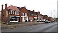
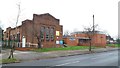
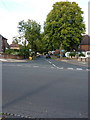
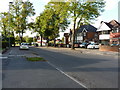
21 photos from this area
Area Information
Key information about the B28 9PN including its size, population, and administrative classification.
- Area Type
- Postcode
- Area Size
- 5498 m²
- Population
- 1922
- Population Density
- 8210 people/km²
House Prices in B28 9PN
20
Properties
£132,871
Average Sold Price
£41,500
Lowest Price
£182,500
Highest Price
Showing 20 properties
| Address | Type | Beds | Baths | Last Sale Price | Last Sale Date | |
|---|---|---|---|---|---|---|
| 120 Pitmaston Road, Birmingham, B28 9PN | Terraced | 3 | 1 | £169,500 | Dec 2023 | |
| 128 Pitmaston Road, Birmingham, B28 9PN | house | - | - | £182,500 | Jun 2021 | |
| 136 Pitmaston Road, Birmingham, B28 9PN | Semi-detached | 3 | - | £160,000 | Jan 2017 | |
| 130 Pitmaston Road, Birmingham, B28 9PN | house | 3 | - | £139,000 | Nov 2016 | |
| 104 Pitmaston Road, Birmingham, B28 9PN | Semi-detached | 3 | - | £157,000 | Feb 2016 | |
| 114 Pitmaston Road, Birmingham, B28 9PN | house | - | - | £130,130 | Oct 2014 | |
| 110 Pitmaston Road, Birmingham, B28 9PN | Semi-detached | - | - | £117,000 | Mar 2009 | |
| 102 Pitmaston Road, Birmingham, B28 9PN | Semi-detached | 3 | - | £124,950 | Mar 2007 | |
| 126 Pitmaston Road, Birmingham, B28 9PN | house | - | - | £125,000 | Sep 2006 | |
| 132 Pitmaston Road, Birmingham, B28 9PN | Terraced | 3 | - | £115,000 | Mar 2006 |
Page 1 of 2
Energy Efficiency in B28 9PN
Amenities
Schools
| Rank | School | Type | Entry gender | Ages |
|---|
Explore more schools in this area
Go to Schools tabDemographics
Household Size
Family (3-5 people)
most common
Accommodation Type
Houses
most common
Tenure
45
majority
Ethnic Group
White
most common
Religion
N/A
most common
Household Composition
N/A
most common
Age
47
median
Adults (30-64 years)
most common
Household Deprivation
N/A
with no deprivation
NS-SEC
18
in Lower managerial occupations
Explore more demographic insights in this area
Go to Demographics tabPlanning
Planning Constraints
- Flood RiskPremium
- Ramsar Wetland SitesPremium
- Area of Outstanding Natural BeautyPremium
- Protected Nature ReservePremium
- Protected WoodlandPremium