Area Overview for B28 8WN
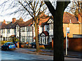
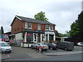
Photos of B28 8WN

Area Information
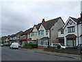
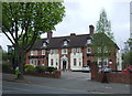
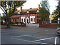
Living in B28 8WN means inhabiting a small, tightly knit residential cluster within Birmingham’s Hall Green area. With a population of 2,047, the postcode reflects a suburban community characterised by early 20th-century housing, tree-lined streets, and low red brick boundary walls. The area is part of Hall Green North Ward, a district recognised for its safety and historical significance. Residents benefit from proximity to both modern amenities and heritage sites, such as the Friends Meeting House and the Church of the Ascension. The mix of interwar properties and later infill developments creates a cohesive, lived-in feel, with homes often set back from roads. Daily life here balances quiet residential charm with practical access to retail, transport, and schools. The area’s reputation as one of Birmingham’s safer districts, combined with its blend of architectural character and contemporary infrastructure, makes it appealing to families and professionals seeking stability.
- Area Type
- Postcode
- Area Size
- Not available
- Population
- 2047
- Population Density
- 4952 people/km²
The property market in B28 8WN is dominated by owner-occupied homes, with 72% of residents living in their own properties. The accommodation type is primarily houses, which is typical of suburban areas with low-rise, traditional housing stock. This suggests a market focused on family homes rather than rental properties, though the small size of the postcode may limit availability. The presence of early 20th-century and interwar properties, alongside later developments, indicates a mix of architectural styles and potential for character homes. For buyers, this means a limited but distinct selection of properties, often with historical features such as red brick facades and tree-lined gardens. Proximity to schools and transport links further enhances the appeal of owning a home here, though the area’s small size means competition for available listings.
House Prices in B28 8WN
No properties found in this postcode.
Energy Efficiency in B28 8WN
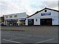
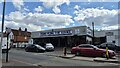
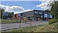
The lifestyle in B28 8WN is shaped by its proximity to a mix of retail, transport, and cultural amenities. Nearby shops include Tesco Hall, Lidl Acocks, and Waitrose Hall, offering a range of grocery and everyday shopping options. The area’s rail and metro connections, such as Hall Green and Grand Central New Street stations, provide easy access to Birmingham’s business districts and leisure hubs. While the postcode itself is small, its integration with Hall Green’s broader district means residents can enjoy tree-lined streets, historic buildings, and community spaces. The presence of the Friends Meeting House and the Church of the Ascension adds a layer of cultural and historical interest. For daily life, the balance of convenience and suburban tranquillity makes B28 8WN appealing to those seeking both accessibility and a sense of place.
Amenities
Schools
Residents of B28 8WN have access to Hall Green School, which operates as both a primary school and an academy with a good Ofsted rating. This dual role provides a seamless educational pathway for families, combining early years schooling with a structured academy system. The good rating suggests a school that meets or exceeds national standards in teaching quality, student outcomes, and resource provision. The presence of a single named school within the area, combined with its dual function, reduces the need for long commutes to other districts. For parents, this offers convenience and continuity, though the absence of additional schools may limit choice. The school’s location opposite the Friends Meeting House also integrates educational and cultural spaces, reinforcing the area’s community-focused ethos.
| Rank | School | Type | Entry gender | Ages |
|---|
Explore more schools in this area
Go to Schools tabDemographics
The population of B28 8WN is predominantly adults aged 30–64, with a median age of 47. This suggests a mature, established community with strong family ties and long-term residency. Home ownership is high at 72%, indicating a stable housing market where most residents live in their own homes rather than renting. The accommodation type is primarily houses, reflecting a suburban layout rather than high-density living. The predominant ethnic group is Asian, which shapes the cultural and social fabric of the area. This demographic profile aligns with broader trends in Birmingham’s safer districts, where older properties and community cohesion are key features. The absence of specific deprivation data means the area’s quality of life is likely supported by its infrastructure and amenities, though further localised analysis would clarify this.
Household Size
Accommodation Type
Tenure
Ethnic Group
Religion
Household Composition
Age
Household Deprivation
NS-SEC
Explore more demographic insights in this area
Go to Demographics tabPlanning
Planning Constraints
- Flood RiskPremium
- Ramsar Wetland SitesPremium
- Area of Outstanding Natural BeautyPremium
- Protected Nature ReservePremium
- Protected WoodlandPremium