Area Overview for B28 8RH
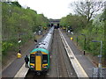
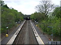
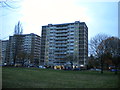
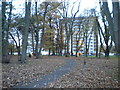
Photos of B28 8RH
Area Information
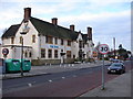
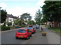
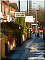
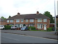
Living in B28 8RH means being part of Hall Green North Ward, a suburban enclave in southeast Birmingham with a population of 1,885. This small residential cluster is characterised by tree-lined streets, low red brick boundary walls, and homes dating from the early twentieth century to interwar periods. The area blends historical architecture with modern convenience, offering a calm, community-focused environment. Hall Green is recognised as one of Birmingham’s safer districts, with a mix of older villas, infill developments, and Art Deco housing blocks like Petersfield Court. Daily life here is defined by proximity to local amenities, historic sites, and transport links. The ward’s residents benefit from a stable, mature community, with employment rates slightly above the city average. Its compact size means a tight-knit feel, where historical landmarks like the Friends Meeting House and Church of the Ascension sit alongside contemporary retail and transport hubs. This is a place where heritage meets practicality, ideal for those seeking a balanced lifestyle in a well-maintained, low-risk environment.
- Area Type
- Postcode
- Area Size
- Not available
- Population
- 1885
- Population Density
- 6711 people/km²
The property market in B28 8RH is dominated by owner-occupied homes, with 76% of properties owned outright. This high home ownership rate reflects a community of long-term residents and a limited rental market, which can make finding available properties challenging for buyers. The accommodation type is predominantly houses, a feature typical of the area’s suburban character and historical development. These homes range from early twentieth-century villas with distinctive architectural features—such as leaded casements and massive chimneys—to interwar and post-war infill properties. The presence of Art Deco housing blocks like Petersfield Court adds diversity to the housing stock. Given the small size of the postcode area, the market is likely to be competitive, with limited new developments. Buyers should consider the scarcity of properties and the potential for long-term value retention, especially in well-maintained historic homes. The area’s low flood risk and proximity to transport links further enhance its appeal for those seeking a stable, secure investment.
House Prices in B28 8RH
No properties found in this postcode.
Energy Efficiency in B28 8RH
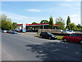
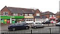
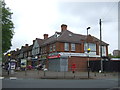
Life in B28 8RH is enriched by a mix of historical landmarks, educational institutions, and practical amenities. The area is home to the Church of the Ascension (1704), a classical architectural gem, and the Friends Meeting House (1883), a Victorian red-brick building with Quaker heritage. Hall Green Junior School, established in 1893, serves local families, while Petersfield Court offers a glimpse into Art Deco design. Retail options include major supermarkets like Tesco Hall and Asda Merestones, ensuring daily convenience. The nearby railway stations and metro links provide seamless access to Birmingham’s cultural and commercial hubs. Parks and green spaces, though not explicitly named in the data, are implied by the area’s tree-lined streets and historic residential layout. This blend of heritage, education, and modern retail creates a lifestyle that balances tranquillity with accessibility, appealing to those who value both history and practicality.
Amenities
Schools
| Rank | School | Type | Entry gender | Ages |
|---|
Explore more schools in this area
Go to Schools tabDemographics
The population of B28 8RH has a median age of 47, with the majority of residents falling within the 30–64 age range. This suggests a mature, stable community with a strong presence of working-age adults. Home ownership is high at 76%, indicating a predominance of long-term residents and a lower rental market. The area’s accommodation is primarily houses, reflecting a traditional suburban layout. The predominant ethnic group is Asian_total, which shapes the cultural fabric of the neighbourhood. While specific deprivation data is not provided, the high home ownership and mature age profile suggest a relatively affluent and settled population. The absence of significant student or younger family populations points to a community focused on stability and continuity. This demographic profile aligns with the area’s reputation as a safe, low-traffic residential zone, where residents prioritise security, historical character, and proximity to essential services.
Household Size
Accommodation Type
Tenure
Ethnic Group
Religion
Household Composition
Age
Household Deprivation
NS-SEC
Explore more demographic insights in this area
Go to Demographics tabPlanning
Planning Constraints
- Flood RiskPremium
- Ramsar Wetland SitesPremium
- Area of Outstanding Natural BeautyPremium
- Protected Nature ReservePremium
- Protected WoodlandPremium