Area Overview for B28 8PE
Photos of B28 8PE
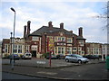
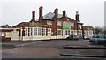
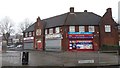

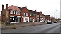

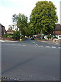
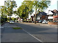
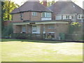
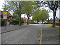
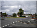
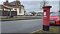
21 photos from this area
Area Information
Key information about the B28 8PE including its size, population, and administrative classification.
- Area Type
- Postcode
- Area Size
- 5824 m²
- Population
- 1902
- Population Density
- 6279 people/km²
House Prices in B28 8PE
12
Properties
£169,431
Average Sold Price
£51,500
Lowest Price
£270,000
Highest Price
Showing 12 properties
| Address | Type | Beds | Baths | Last Sale Price | Last Sale Date | |
|---|---|---|---|---|---|---|
| 207 School Road, Hall Green, Birmingham, B28 8PE | house | - | - | £270,000 | Aug 2025 | |
| 183 School Road, Hall Green, Birmingham, B28 8PE | house | - | - | £250,000 | Dec 2021 | |
| 203 School Road, Hall Green, Birmingham, B28 8PE | Terraced | 3 | - | £177,000 | Feb 2016 | |
| 179 School Road, Hall Green, Birmingham, B28 8PE | house | - | - | £160,000 | Nov 2007 | |
| 199 School Road, Hall Green, Birmingham, B28 8PE | Semi-detached | 3 | 1 | £197,000 | Feb 2007 | |
| 205 School Road, Hall Green, Birmingham, B28 8PE | house | - | - | £149,950 | Dec 2006 | |
| 209 School Road, Hall Green, Birmingham, B28 8PE | Detached | - | - | £100,000 | Jul 1999 | |
| 201 School Road, Hall Green, Birmingham, B28 8PE | Terraced | - | - | £51,500 | Jan 1995 | |
| 187 School Road, Hall Green, Birmingham, B28 8PE | Semi-detached | 4 | - | - | - | |
| 189 School Road, Hall Green, Birmingham, B28 8PE | house | 4 | - | - | - |
Page 1 of 2
Energy Efficiency in B28 8PE
Amenities
Schools
| Rank | School | Type | Entry gender | Ages |
|---|
Explore more schools in this area
Go to Schools tabDemographics
Household Size
Family (3-5 people)
most common
Accommodation Type
Houses
most common
Tenure
80
majority
Ethnic Group
asian_total
most common
Religion
N/A
most common
Household Composition
N/A
most common
Age
47
median
Adults (30-64 years)
most common
Household Deprivation
N/A
with no deprivation
NS-SEC
30
in Lower managerial occupations
Explore more demographic insights in this area
Go to Demographics tabPlanning
Planning Constraints
- Flood RiskPremium
- Ramsar Wetland SitesPremium
- Area of Outstanding Natural BeautyPremium
- Protected Nature ReservePremium
- Protected WoodlandPremium